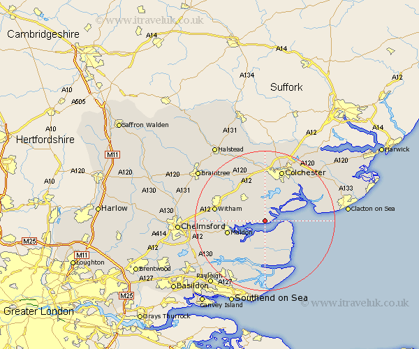
Essex Map Showing Location of Tollesbury
Population: 2274
Area Size (ha): 76
District: Maldon
Easting: 595554 Northing: 209549
Latitude: 51.75 Longitude: 0.83
 = Tollesbury
Area Size (ha): 76
District: Maldon
Easting: 595554 Northing: 209549
Latitude: 51.75 Longitude: 0.83
= Tollesbury
This Tollesbury map below is supplied by Google. Use the tools in the top left corner to zoom into street level or zoom out for a road map, you may also need to zoom in to see Tollesbury on the map. Click and drag the map to move around. If the map fails to load try and refresh your browser or zoom in or out (+ or -).
Update - it seems Google no longer allow people to use their maps for free! This Tollesbury map sometimes loads and sometimes gives a error. I am working on a solution.
Closest 30 Towns or Cities to Tollesbury (Population over 500)
Tolleshunt D'Arcy 2.95km Tolleshunt Major 4.59km West Mersea 4.95km Tolleshunt Knights 5.05km Goldhanger 6.03km Tillingham 8.18km Peldon 8.72km Tiptree 8.85km Birch 9.33km Layer de la Haye 9.33km Heybridge 10.49km Totham 10.73km Great Totham 10.73km Malden 10.97km Maldon 10.97km Southminster 11.12km Copford 11.35km Fingringhoe 11.54km Latchingdon and Snoreham 11.54km Snoreham 11.54km Latchingdon 11.54km Mayland 11.64km Wickham Bishops 12.05km Althorne 12.52km Kelvedon 13.04km Marks Tey 13.42km Rowhedge 13.71km Feering 13.71km Witham 14.25km Wivenhoe 14.41km