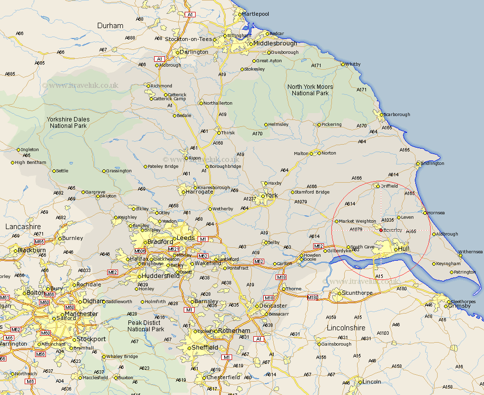
Yorkshire Map Showing Location of Beverley
Population: 23277
Area Size (ha): 591
Easting: 504186 Northing: 438634
Latitude: 53.83 Longitude: -0.42
 = Beverley
Area Size (ha): 591
Easting: 504186 Northing: 438634
Latitude: 53.83 Longitude: -0.42
= Beverley
This Beverley map below is supplied by Google. Use the tools in the top left corner to zoom into street level or zoom out for a road map, you may also need to zoom in to see Beverley on the map. Click and drag the map to move around. If the map fails to load try and refresh your browser or zoom in or out (+ or -).
Update - it seems Google no longer allow people to use their maps for free! This Beverley map sometimes loads and sometimes gives a error. I am working on a solution.
Closest 30 Towns or Cities to Beverley (Population over 500)
Woodmansey 2.86km Leckonfield 4.31km Leconfield 4.31km Tickton 4.31km Bishop Burton 5.47km Wawne 5.73km Cottingham 5.97km Skidby 6.46km Cherry Burton 6.61km Willerby 7.72km Leven 8.6km Sutton-on-Hull 8.6km Sutton on Hull 8.6km Sutton 8.6km Lockington 8.61km Kirk Ella 9.52km Hull 10.13km Skirlaugh Station 11.09km Anlaby 11.17km Swanland 11.95km Brandsburton 12.02km Brandesburton 12.02km Hessle 13.01km Cranswick 13.02km Ferriby 14.07km North Ferriby 14.07km Kingston upon Hull 14.07km South Cave 14.13km Welton 14.86km North Frodingham 15.46km