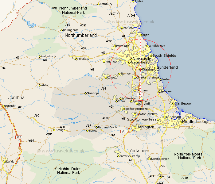
Durham Map Showing Location of Washington
Population: 55760
Area Size (ha): 1230
District: Sunderland
Easting: 430991 Northing: 556257
Latitude: 54.9 Longitude: -1.52
 = Washington
Area Size (ha): 1230
District: Sunderland
Easting: 430991 Northing: 556257
Latitude: 54.9 Longitude: -1.52
= Washington
This Washington map below is supplied by Google. Use the tools in the top left corner to zoom into street level or zoom out for a road map, you may also need to zoom in to see Washington on the map. Click and drag the map to move around. If the map fails to load try and refresh your browser or zoom in or out (+ or -).
Update - it seems Google no longer allow people to use their maps for free! This Washington map sometimes loads and sometimes gives a error. I am working on a solution.
Closest 30 Towns or Cities to Washington (Population over 500)
Birtley 3.7km Lamesley 5.64km Ouston Moor 6.1km Ouston 6.1km Boldon 6.41km West Boldon 6.41km Chester-le-Street 6.41km Houghton le Spring 6.41km Pelton 6.49km Felling 6.71km Hebburn on Tyne 7.42km Hebburn-on-Tyne 7.42km Hebburn 7.42km Gateshead-on-Tyne 8.16km Gateshead on Tyne 8.16km Gateshead 8.16km Sunderland 8.63km Edmondsley 9.31km West Rainton 9.32km Jarrow-on-Tyne 9.9km Jarrow on Tyne 9.9km Jarrow 9.9km Hetton le Hole 10.2km Whitburn 11.16km Sacriston 11.26km Murton 11.26km Whickham 11.28km Seaton 11.31km Pittington 11.32km Marsden 12.12km