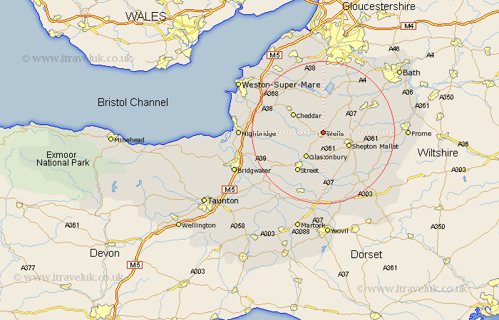
Somerset Map Showing Location of Wells
Population: 9899
Area Size (ha): 321
District: Mendip
Easting: 354607 Northing: 146646
Latitude: 51.22 Longitude: -2.65
 = Wells
Area Size (ha): 321
District: Mendip
Easting: 354607 Northing: 146646
Latitude: 51.22 Longitude: -2.65
= Wells
This Wells map below is supplied by Google. Use the tools in the top left corner to zoom into street level or zoom out for a road map, you may also need to zoom in to see Wells on the map. Click and drag the map to move around. If the map fails to load try and refresh your browser or zoom in or out (+ or -).
Update - it seems Google no longer allow people to use their maps for free! This Wells map sometimes loads and sometimes gives a error. I am working on a solution.
Closest 30 Towns or Cities to Wells (Population over 500)
Wookey 2.97km Westbury 5km Rodney Stoke 6.88km Chewton Mendip 7.24km Pilton 7.24km West Pennard 7.42km Shepun 7.89km Shepton Mallet 7.89km Glastonbury 8.44km Priddy 8.93km Compton Martin 9.26km East Harptree 9.34km Cheddar 9.84km Meare 10.83km Farrington Gurney 10.99km Baltonsborough 11.12km Wedmore 11.61km Holcombe 11.75km Stratton on the Fosse 11.83km Stratton-on-the-Fosse 11.83km Stratton 11.83km Chilcompton 11.83km Axbridge 12.8km Evercreech 12.82km Barton St David 12.98km Barton Saint David 12.98km Barton St. David 12.98km Street 13.12km Butleigh 13.18km Coleford 13.43km