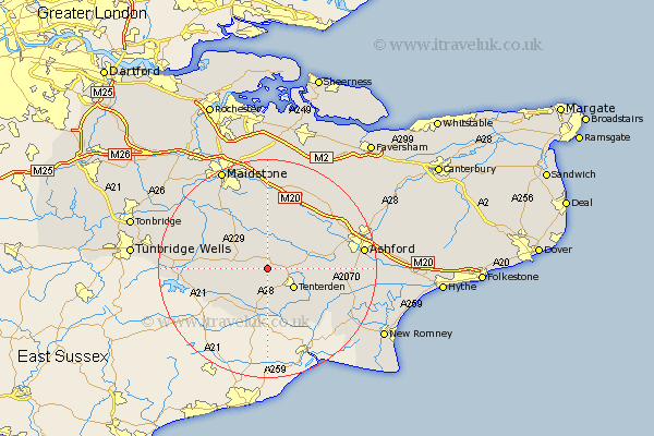
Kent Map Showing Location of Biddenden
Population: 2434
District: Ashford
Easting: 584351 Northing: 136767
Latitude: 51.1 Longitude: 0.63
 = Biddenden
District: Ashford
Easting: 584351 Northing: 136767
Latitude: 51.1 Longitude: 0.63
= Biddenden
This Biddenden map below is supplied by Google. Use the tools in the top left corner to zoom into street level or zoom out for a road map, you may also need to zoom in to see Biddenden on the map. Click and drag the map to move around. If the map fails to load try and refresh your browser or zoom in or out (+ or -).
Update - it seems Google no longer allow people to use their maps for free! This Biddenden map sometimes loads and sometimes gives a error. I am working on a solution.
Closest 30 Towns or Cities to Biddenden (Population over 500)
Smarden 5.09km Frittenden 5.09km Headcorn 5.68km Tenterden 6km High Halden 6.11km Benenden 6.57km Beneden 6.57km Cranbrook 7.23km Rolvenden 7.42km Staplehurst 8.92km Bethersden 9.49km Woodchurch 10.02km Sandhurst 10.37km Ulcombe 11.18km Egerton 11.6km Sutton Valence 11.65km Marden 11.9km Hawkhurst 11.91km Wittersham 12.06km Pluckley 12.33km Shadoxhurst 12.8km Goudhurst 12.8km Hothfield 13.95km Horsmonden 14.09km Boughton Monchelsea 14.73km Leeds 14.87km Kingsnorth 15.13km Langley 15.23km Harrietsham 15.23km Hunton 15.27km