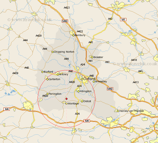
Oxfordshire Map Showing Location of West Hanney
Population: 496
District: Vale of White Horse
Easting: 441537 Northing: 191093
Latitude: 51.62 Longitude: -1.4
 = West Hanney
District: Vale of White Horse
Easting: 441537 Northing: 191093
Latitude: 51.62 Longitude: -1.4
= West Hanney
This West Hanney map below is supplied by Google. Use the tools in the top left corner to zoom into street level or zoom out for a road map, you may also need to zoom in to see West Hanney on the map. Click and drag the map to move around. If the map fails to load try and refresh your browser or zoom in or out (+ or -).
Update - it seems Google no longer allow people to use their maps for free! This West Hanney map sometimes loads and sometimes gives a error. I am working on a solution.
Closest 30 Towns or Cities to West Hanney (Population over 500)
Hanney 0km East Hanney 0km Wantage 3.71km East Challow 5.07km Kingston Bagpuze 5.68km Kingston Bagpuize 5.68km Steventon 5.75km Marcham 5.91km Letcombe Regis 6.54km Childrey 6.85km Milton 6.9km Drayton 7.15km Stanford in the Vale 7.15km Longworth 7.76km Harwell 8.27km Buckland 8.86km Sutton Courtenay 9.39km Abingdon 9.79km Abingdon on Thames 9.79km Abingdon-on-Thames 9.79km Didcot 10.52km Sunningwell 10.94km Uffington 11.01km Standlake 11.18km Wootton 11.55km Long Wittenham 11.65km Chilton 11.82km Cumnor 12.04km Hagbourne 12.09km East Hagbourne 12.09km