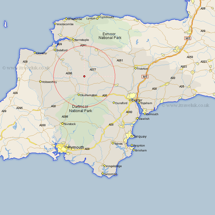
Devon Map Showing Location of Winkleigh
District: Torridge
Easting: 262747 Northing: 107482
Latitude: 50.85 Longitude: -3.95
 = Winkleigh
Easting: 262747 Northing: 107482
Latitude: 50.85 Longitude: -3.95
= Winkleigh
This Winkleigh map below is supplied by Google. Use the tools in the top left corner to zoom into street level or zoom out for a road map, you may also need to zoom in to see Winkleigh on the map. Click and drag the map to move around. If the map fails to load try and refresh your browser or zoom in or out (+ or -).
Update - it seems Google no longer allow people to use their maps for free! This Winkleigh map sometimes loads and sometimes gives a error. I am working on a solution.
Closest 30 Towns or Cities to Winkleigh (Population over 500)
North Tawton 6.58km Dolton 6.92km Sampford Courtnay 7.42km Sampford Courtenay 7.42km Sampford Courtney 7.42km Hatherleigh 8.99km Burrington 9.26km Barrington 9.26km Chulmleigh 9.44km Chawleigh 9.9km Lapford 10.69km Bow 10.89km Nymet Tracey 10.89km Okehampton 13.44km High Bickington 13.44km South Tawton 13.44km Morchard Bishop 14.04km Northlew 14.93km Copplestone 15.11km Black Torrington 16.8km Great Torrington 17.9km Torrington 17.9km Witheridge 17.97km Chittlehampton 18.54km Shebbear 18.72km Langtree 19.04km Cheriton Bishop 20.01km Sandford 20.24km South Molton 20.26km Chagford 20.27km