Durham Map Showing Location of Billingham
Population: 36139
Area Size (ha): 114
Easting: 445217 Northing: 522996
Latitude: 54.6 Longitude: -1.3
 = Billingham
Area Size (ha): 114
Easting: 445217 Northing: 522996
Latitude: 54.6 Longitude: -1.3
= Billingham
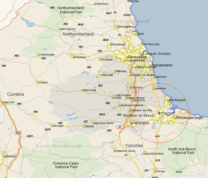
This Billingham map below is supplied by Google. Use the tools in the top left corner to zoom into street level or zoom out for a road map, you may also need to zoom in to see Billingham on the map. Click and drag the map to move around. If the map fails to load try and refresh your browser or zoom in or out (+ or -).
Update - it seems Google no longer allow people to use their maps for free! This Billingham map sometimes loads and sometimes gives a error. I am working on a solution.
Closest 30 Towns or Cities to Billingham (Population over 500)
Wolviston 2.15km Stockton-on-Tees 4.09km Stockton 4.09km Stockton on Tees 4.09km Greatham 5.67km Grindon 5.68km Carlton 6.71km Thornaby-on-Tees 7.42km Thornaby on Tees 7.42km Thornaby 7.42km Eaglescliffe 8.08km Stillington 8.59km Elwick 9.32km Egglescliffe 9.81km Sedgefield 10.23km Hartlepool 10.71km Yarm-on-Tees 11.58km Yarm on Tees 11.58km Yarm 11.58km Fishburn 12.63km Hart 13.15km Hutton Henry 13.37km Trimdon 13.42km Bishop Middleham 15km Wingate 15.76km Horden 16.71km Hesleden 16.71km Newton Aycliffe 17.27km Cornforth 17.83km West Cornforth 17.83km