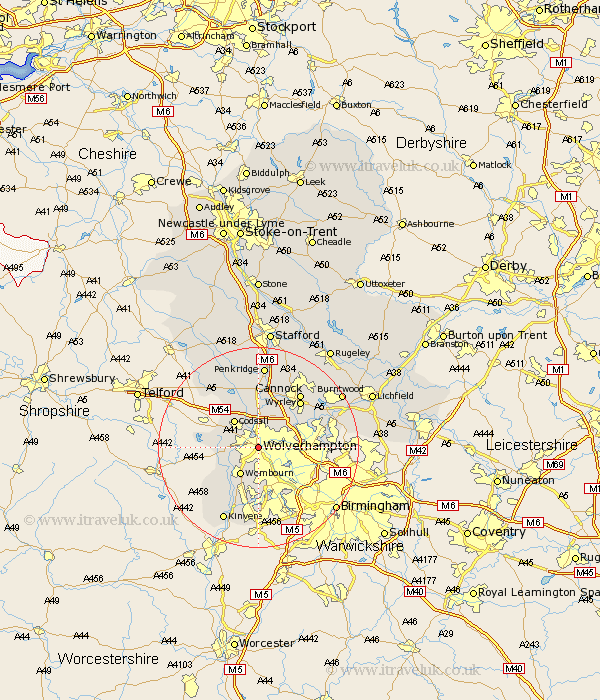
Staffordshire Map Showing Location of Wolverhampton
Population: 256122
Area Size (ha): 6776
District: Wolverhampton
Easting: 390967 Northing: 298435
Latitude: 52.58 Longitude: -2.13
 = Wolverhampton
Area Size (ha): 6776
District: Wolverhampton
Easting: 390967 Northing: 298435
Latitude: 52.58 Longitude: -2.13
= Wolverhampton
This Wolverhampton map below is supplied by Google. Use the tools in the top left corner to zoom into street level or zoom out for a road map, you may also need to zoom in to see Wolverhampton on the map. Click and drag the map to move around. If the map fails to load try and refresh your browser or zoom in or out (+ or -).
Update - it seems Google no longer allow people to use their maps for free! This Wolverhampton map sometimes loads and sometimes gives a error. I am working on a solution.
Closest 30 Towns or Cities to Wolverhampton (Population over 500)
Bilston 4.87km Lower Penn 4.87km Wombourn 6.51km Wombourne 6.51km Codsall 7.15km Himley 7.49km Scisdon 8.1km Seisdon 8.1km Pattingham 9.01km Wallsall 9.2km Walsall 9.2km Dudley 9.86km Shareshill 9.87km Brewood 11.35km West Bromwich 11.67km Great Wyrley 12.39km Wyrley 12.39km Rushall 12.52km Bobbington 12.56km Pelsall 12.93km Smethwick 12.93km Cannock 13.62km Brownhills 14.6km Huntington 14.63km Aldridge 14.75km Hednesford 15.79km Norton Canes 15.82km Wheaton Aston 15.86km Kinvere 16.29km Weston-under-Lizard 16.46km