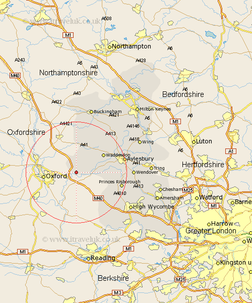
Buckinghamshire Map Showing Location of Warminghall
Population: 555
District: Aylesbury Vale
Easting: 464399 Northing: 208016
Latitude: 51.77 Longitude: -1.07
 = Warminghall
District: Aylesbury Vale
Easting: 464399 Northing: 208016
Latitude: 51.77 Longitude: -1.07
= Warminghall
This Warminghall map below is supplied by Google. Use the tools in the top left corner to zoom into street level or zoom out for a road map, you may also need to zoom in to see Warminghall on the map. Click and drag the map to move around. If the map fails to load try and refresh your browser or zoom in or out (+ or -).
Update - it seems Google no longer allow people to use their maps for free! This Warminghall map sometimes loads and sometimes gives a error. I am working on a solution.
Closest 30 Towns or Cities to Warminghall (Population over 500)
Oakley 3.71km Brill 5.68km Long Crendon 5.73km Chearsley 8.03km Haddenham 10.32km Cuddington 10.48km Grendon Underwood 12.03km Waddesdon 12.7km Bledlow 14.85km Marsh Gibbon 14.87km Quainton 15.16km Stone 15.36km Longwick 15.37km Radnage 16.6km Stokenchurch 17.33km Princes Risborough 18.09km Twyford 18.67km Great Kimble 18.73km Kimble 18.73km North Marston 18.9km Aylesbury 19.17km Steeple Claydon 19.39km Claydon 19.39km Stoke Mandeville 19.58km Ellesborough 19.59km Whitechurch 20.62km Whitchurch 20.62km Lane End 21.64km Wendover 21.79km Weston Turville 21.87km