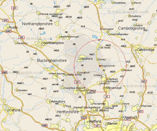
Bedfordshire Map Showing Location of Easton
District: Mid Bedfordshire
Easting: 518757 Northing: 244235
Latitude: 52.08 Longitude: -0.27
 = Easton
Easting: 518757 Northing: 244235
Latitude: 52.08 Longitude: -0.27
= Easton
This Easton map below is supplied by Google. Use the tools in the top left corner to zoom into street level or zoom out for a road map, you may also need to zoom in to see Easton on the map. Click and drag the map to move around. If the map fails to load try and refresh your browser or zoom in or out (+ or -).
Update - it seems Google no longer allow people to use their maps for free! This Easton map sometimes loads and sometimes gives a error. I am working on a solution.
Closest 30 Towns or Cities to Easton (Population over 500)
Langford 3.7km Northill 3.89km Southill 4.35km Sandy 5.47km Potton 5.88km Everton 6.01km Clifton 6.01km Blunham 6.52km Shefford 7.19km Henlow 7.49km Tempsford 7.76km Cople 8.79km Cockayne Hatley 8.79km Willington 8.81km Campton and Chicksands 8.81km Arlesley 9.33km Arlesey 9.33km Great Barford 9.35km Roxton 9.55km Stotfold 9.87km Stondon 9.87km Meppershall 10.32km Haynes 10.9km Gravenhurst 11.51km Wilhamstead 11.54km Willshamstead 11.54km Wilshamstead 11.54km Wilstead 11.54km Shillington 12.5km Clophill 12.65km