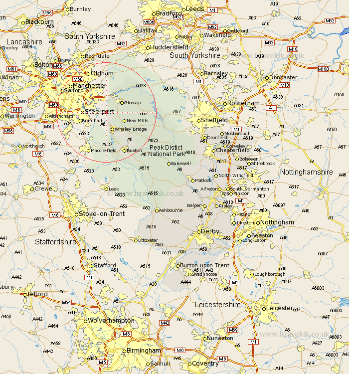
Derbyshire Map Showing Location of Mellor
District: Stockport
Easting: 398891 Northing: 389270
Latitude: 53.4 Longitude: -2.02
 = Mellor
Easting: 398891 Northing: 389270
Latitude: 53.4 Longitude: -2.02
= Mellor
This Mellor map below is supplied by Google. Use the tools in the top left corner to zoom into street level or zoom out for a road map, you may also need to zoom in to see Mellor on the map. Click and drag the map to move around. If the map fails to load try and refresh your browser or zoom in or out (+ or -).
Update - it seems Google no longer allow people to use their maps for free! This Mellor map sometimes loads and sometimes gives a error. I am working on a solution.
Closest 30 Towns or Cities to Mellor (Population over 500)
Charlesworth 3.86km Hayfield 4.8km Glossop 7.05km New Mills 7.6km Whaley Bridge 7.74km Tintwhistle 8.12km Tintwistle 8.12km Chapel en le Frith 12.07km Buxton 17.95km Castleton 18.17km Hope 18.54km Bradwell 19.97km Tideswell 22.26km Bamford 22.8km Hathersage 26.04km Eyam 26.61km Longstone 28.04km Great Longstone 28.04km Stony Middleton 28.5km Stoney Middleton 28.5km Grindleford Bridge 28.57km Grindleford 28.57km Bakewell 32.18km Baslow 32.4km Middleton 32.72km Youlgreave 33.41km Holmesfield 35.64km Darley Dale 37.95km Dronfield 38.16km Barlow 38.39km