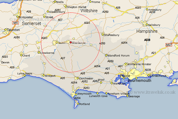
Dorset Map Showing Location of Sherborne
Population: 8737
Area Size (ha): 286
District: West Dorset
Easting: 364880 Northing: 116909
Latitude: 50.95 Longitude: -2.5
 = Sherborne
Area Size (ha): 286
District: West Dorset
Easting: 364880 Northing: 116909
Latitude: 50.95 Longitude: -2.5
= Sherborne
This Sherborne map below is supplied by Google. Use the tools in the top left corner to zoom into street level or zoom out for a road map, you may also need to zoom in to see Sherborne on the map. Click and drag the map to move around. If the map fails to load try and refresh your browser or zoom in or out (+ or -).
Update - it seems Google no longer allow people to use their maps for free! This Sherborne map sometimes loads and sometimes gives a error. I am working on a solution.
Closest 30 Towns or Cities to Sherborne (Population over 500)
Sherbourne 0km Sherborne 0km Bradford Abbas 6.91km Yetminster 7.26km Stalbridge 9.34km Leigh 9.9km Marnhull 12.97km Buckland Newton 13.44km Stour Provost 15.62km Sturminster Newton 15.63km Stour 16.16km East Stour 16.16km Cerne Abbas 16.84km Bourton 17.45km Shillingstone 18.38km Gillingham 18.78km Child Okeford 19.05km Piddletrenthide 19.44km Puddletrenthide 19.44km Maiden Newton 20.91km Motcombe 21.18km Shaftesbury 21.73km Mosterton 21.76km Fontmell Magna 22.18km Iwerne Minster 22.27km Stourpaine 22.3km Milton Abbas 22.57km Winterborne Stickland 22.77km Stickland Winterborne 22.77km Beaminster 24.2km