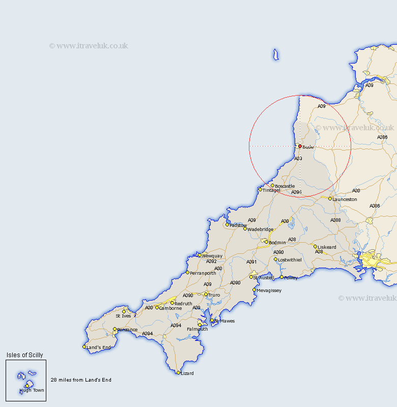
Cornwall Map Showing Location of Bude
Population: 3966
Area Size (ha): 114
District: North Cornwall
Easting: 221629 Northing: 106872
Latitude: 50.83 Longitude: -4.53
 = Bude
Area Size (ha): 114
District: North Cornwall
Easting: 221629 Northing: 106872
Latitude: 50.83 Longitude: -4.53
= Bude
This Bude map below is supplied by Google. Use the tools in the top left corner to zoom into street level or zoom out for a road map, you may also need to zoom in to see Bude on the map. Click and drag the map to move around. If the map fails to load try and refresh your browser or zoom in or out (+ or -).
Update - it seems Google no longer allow people to use their maps for free! This Bude map sometimes loads and sometimes gives a error. I am working on a solution.
Closest 30 Towns or Cities to Bude (Population over 500)
Marhamchurch 3.88km Markhamchurch 3.88km Kilkhampton 6.58km Pounstock 7.5km Poundstock 7.5km Morwenstow 7.51km Moorwinstow 7.51km North Petherwin 18.1km Forrabury 21.08km Tintagel 23.99km Launceston 25.14km Altarnun 25.94km Camelford 26.3km South Petherwin 26.3km Lewannick 26.88km Lezant 30.65km North Hill 32.28km Linkinhorne 35.36km Blisland 36.76km Cardingham 39.78km Cardinham 39.78km Callington 40.55km Wadebridge 41.06km Dobwalls 42.64km Bodmin 42.76km Liskeard 43.02km Padstow 43.67km Menheniot 45.23km Bere Alston 45.46km Calstock 45.46km