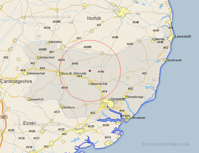
Suffolk Map Showing Location of Wyverstone
Population: 382
District: Mid Suffolk
Easting: 603545 Northing: 267407
Latitude: 52.27 Longitude: 0.98
 = Wyverstone
District: Mid Suffolk
Easting: 603545 Northing: 267407
Latitude: 52.27 Longitude: 0.98
= Wyverstone
This Wyverstone map below is supplied by Google. Use the tools in the top left corner to zoom into street level or zoom out for a road map, you may also need to zoom in to see Wyverstone on the map. Click and drag the map to move around. If the map fails to load try and refresh your browser or zoom in or out (+ or -).
Update - it seems Google no longer allow people to use their maps for free! This Wyverstone map sometimes loads and sometimes gives a error. I am working on a solution.
Closest 30 Towns or Cities to Wyverstone (Population over 500)
Bacton 2.27km Badwell Ash 4.9km Haughley 5.56km Gislingham 5.85km Elmswell 5.86km Mendlesham 5.97km Old Newton 6.01km Botesdale 7.75km Stanton 7.94km Woolpit 7.94km Norton 8.16km Hepworth 8.68km Stowmarket 9.27km Pakenham 10.21km Wortham 10.31km Thorndon 10.37km Bardwell 10.64km Ixworth 10.85km Barningham 10.86km Redgrave 11.18km Thurston 11.5km Rattlesden 11.51km Hopton 11.63km Great Finborough 11.63km Finborough 11.63km Eye 12.63km Honington 14.5km Bradfield 14.52km Bradfield Saint George 14.52km Bradfield St. George 14.52km