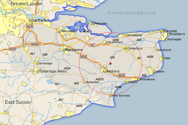
Kent Map Showing Location of Wye
Population: 1702
Area Size (ha): 59
District: Ashford
Easting: 604979 Northing: 146822
Latitude: 51.18 Longitude: 0.93
 = Wye
= Wye
Area Size (ha): 59
District: Ashford
Easting: 604979 Northing: 146822
Latitude: 51.18 Longitude: 0.93
= Wye
This Wye map below is supplied by Google. Use the tools in the top left corner to zoom into street level or zoom out for a road map, you may also need to zoom in to see Wye on the map. Click and drag the map to move around. If the map fails to load try and refresh your browser or zoom in or out (+ or -).
Update - it seems Google no longer allow people to use their maps for free! This Wye map sometimes loads and sometimes gives a error. I am working on a solution.
Closest 30 Towns or Cities to Wye (Population over 500)
Kennington 5.09km Hinxhill 5.56km Chilham 6.02km Ashford 6.56km Brabourne 7.25km Smeeth 7.76km Petham 8.94km Hothfield 8.94km Mersham 9.26km Stelling 9.29km Selling 9.35km Chartham 9.42km Charing 9.47km Sellindge 10.36km Sellinge 10.36km Lower Hardres 10.83km Kingsnorth 10.94km Aldington 11.18km Dunkirk 11.65km Shadoxhurst 12.33km Pluckley 12.78km Lyminge 12.82km Harbledown 13.12km Elham 13.31km Ospringe 13.78km Bethersden 13.78km Bridge 13.93km Egerton 13.94km Orlestone 14.21km Canterbury 14.24km