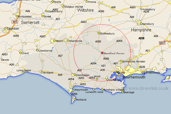
Dorset Map Showing Location of Blandford Forum
Population: 8767
Area Size (ha): 218
District: North Dorset
Easting: 388272 Northing: 107541
Latitude: 50.87 Longitude: -2.17
 = Blandford Forum
Area Size (ha): 218
District: North Dorset
Easting: 388272 Northing: 107541
Latitude: 50.87 Longitude: -2.17
= Blandford Forum
This Blandford Forum map below is supplied by Google. Use the tools in the top left corner to zoom into street level or zoom out for a road map, you may also need to zoom in to see Blandford Forum on the map. Click and drag the map to move around. If the map fails to load try and refresh your browser or zoom in or out (+ or -).
Update - it seems Google no longer allow people to use their maps for free! This Blandford Forum map sometimes loads and sometimes gives a error. I am working on a solution.
Closest 30 Towns or Cities to Blandford Forum (Population over 500)
Stourpaine 2.98km Pimperne 2.98km Tarrant Monkton 5.85km Stickland Winterborne 5.97km Winterborne Stickland 5.97km Spetisbury 6.58km Shillingstone 6.92km Child Okeford 7.26km Iwerne Minster 7.5km Whitechurch 8.77km Fontmell Magna 9.34km Sturminster Newton 9.89km Milton Abbas 11.05km Winterborne Kingston 11.36km Sturminster Marshall 11.63km Charlton 13.17km Corfe Mullen 13.18km Bere Regis 13.44km Milborne Saint Andrew 13.81km Milborne 13.81km Milborne St. Andrew 13.81km Milborne St Andrew 13.81km Wimborne 14.34km Wimborne Minster 14.34km Lytchett Matravers 14.76km Handley 14.91km Shaftesbury 15.01km Marnhull 15.3km Horton 15.32km Stour Provost 15.33km