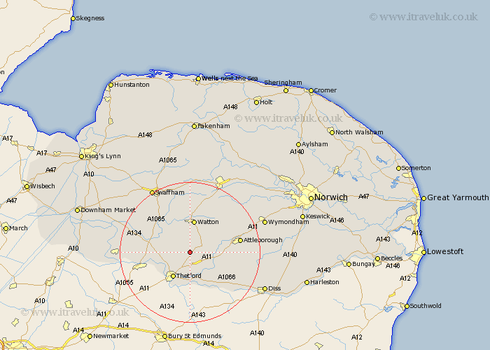
Norfolk Map Showing Location of East Wretham
Population: 366
District: Breckland
Easting: 591238 Northing: 291035
Latitude: 52.48 Longitude: 0.82
 = East Wretham
District: Breckland
Easting: 591238 Northing: 291035
Latitude: 52.48 Longitude: 0.82
= East Wretham
This East Wretham map below is supplied by Google. Use the tools in the top left corner to zoom into street level or zoom out for a road map, you may also need to zoom in to see East Wretham on the map. Click and drag the map to move around. If the map fails to load try and refresh your browser or zoom in or out (+ or -).
Update - it seems Google no longer allow people to use their maps for free! This East Wretham map sometimes loads and sometimes gives a error. I am working on a solution.
Closest 30 Towns or Cities to East Wretham (Population over 500)
Hockham 4.88km Griston 8.15km Thetford 8.68km Rockland St. Peter 8.76km Rockland 8.76km Rockland Saint Peter 8.76km Rockland St Peter 8.76km Harling 9.31km Watton 9.34km East Harling 9.66km Mundford 11.44km Great Ellingham 11.57km Quidenham 11.88km Carbrooke 12km Carbooke 12km Kenninghall 12.59km Ashill 13.02km Attleborough 14.04km Weeting 14.05km Garboldisham 14.33km Besthorpe 15.13km Banham 15.14km North Lopham 15.5km Old Buckenham 15.8km Hingham 15.83km Shipdham 15.87km Northwold 16.43km Bressingham 18.42km Methwold 18.43km Hockwold 18.44km