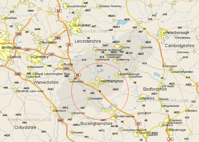
Northamptonshire Map Showing Location of Wootton
Population: 3378
Area Size (ha): 119
District: South Northamptonshire
Easting: 476337 Northing: 254527
Latitude: 52.18 Longitude: -0.88
 = Wootton
Area Size (ha): 119
District: South Northamptonshire
Easting: 476337 Northing: 254527
Latitude: 52.18 Longitude: -0.88
= Wootton
This Wootton map below is supplied by Google. Use the tools in the top left corner to zoom into street level or zoom out for a road map, you may also need to zoom in to see Wootton on the map. Click and drag the map to move around. If the map fails to load try and refresh your browser or zoom in or out (+ or -).
Update - it seems Google no longer allow people to use their maps for free! This Wootton map sometimes loads and sometimes gives a error. I am working on a solution.
Closest 30 Towns or Cities to Wootton (Population over 500)
Collingtree 1.14km Hardingstone 1.86km Milton 2.27km Roade 3.7km Blisworth 3.88km Hackleton 4.55km Houghton 5.04km Great Houghton 5.04km Gayton 5.97km Hartwell 6.01km Kislingbury 6.79km Northampton 7.42km Denton 8.17km Great Billing 8.7km Billing 8.7km Harpole 8.79km Towcester 8.8km Bugbrooke 9.28km Pattishall 9.28km Yardley Hastings 10.39km Whiston 10.65km Boughton 11.18km Moulton 11.35km Paulerspury 11.63km Earls Barton 11.73km Overstone 12.01km Flore 12.65km Potterspury 12.97km Pitsford 12.98km Weedon 13.04km