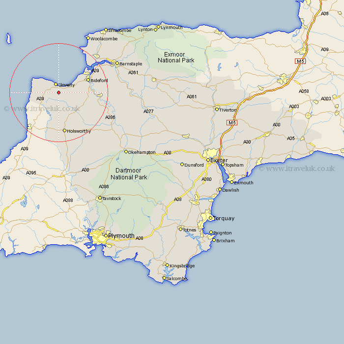
Devon Map Showing Location of Woolfardisworthy
Population: 1123
District: Torridge
Easting: 232668 Northing: 121351
Latitude: 50.97 Longitude: -4.38
 = Woolfardisworthy
District: Torridge
Easting: 232668 Northing: 121351
Latitude: 50.97 Longitude: -4.38
= Woolfardisworthy
This Woolfardisworthy map below is supplied by Google. Use the tools in the top left corner to zoom into street level or zoom out for a road map, you may also need to zoom in to see Woolfardisworthy on the map. Click and drag the map to move around. If the map fails to load try and refresh your browser or zoom in or out (+ or -).
Update - it seems Google no longer allow people to use their maps for free! This Woolfardisworthy map sometimes loads and sometimes gives a error. I am working on a solution.
Closest 30 Towns or Cities to Woolfardisworthy (Population over 500)
Parkham 5.84km Bradworthy 7.42km Hartland 7.92km Buckland Brewer 9.34km Bideford 12.92km Northam 13.82km Langtree 14km Appledore 15.82km Torrington 16.45km Great Torrington 16.45km Holsworthy 16.85km Shebbear 17.46km Instow 17.77km Pyworthy 18.57km Bridgerule 18.87km Braunton 20.38km Fremington 21.72km Black Torrington 21.79km Georgeham 22.53km Halwill 24.61km Tawstock 25.09km Dolton 26.23km Barnstaple 26.68km Marwood 26.8km High Bickington 26.84km Ashwater 26.89km Morthoe 27.28km Mortehoe 27.28km Hatherleigh 27.78km West Down 29.01km