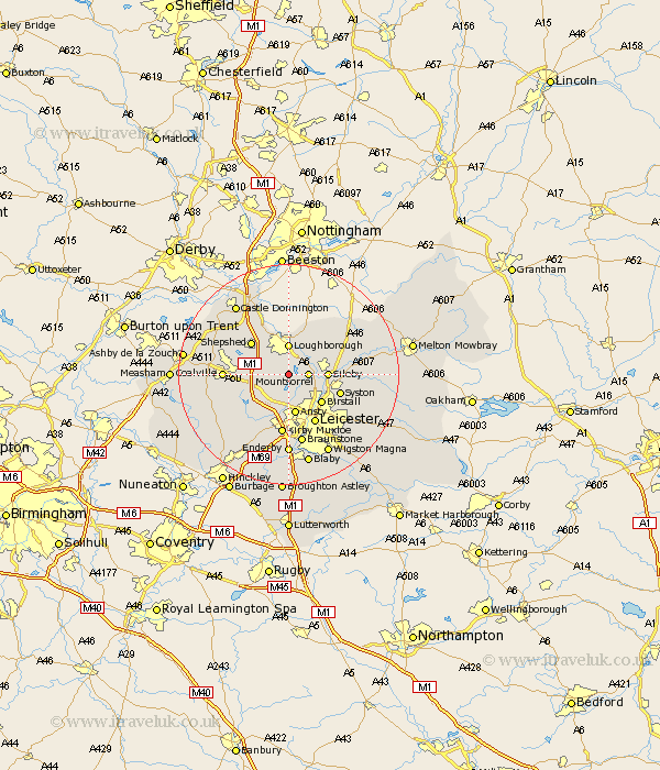
Leicestershire Map Showing Location of Woodhouse
Population: 2013
District: Charnwood
Easting: 454033 Northing: 313565
Latitude: 52.72 Longitude: -1.2
 = Woodhouse
District: Charnwood
Easting: 454033 Northing: 313565
Latitude: 52.72 Longitude: -1.2
= Woodhouse
This Woodhouse map below is supplied by Google. Use the tools in the top left corner to zoom into street level or zoom out for a road map, you may also need to zoom in to see Woodhouse on the map. Click and drag the map to move around. If the map fails to load try and refresh your browser or zoom in or out (+ or -).
Update - it seems Google no longer allow people to use their maps for free! This Woodhouse map sometimes loads and sometimes gives a error. I am working on a solution.
Closest 30 Towns or Cities to Woodhouse (Population over 500)
Quorndon 2.91km Mountsorrel 3.37km Barrow upon Soar 3.84km Barrow 3.84km Rothley 4.86km Loughborough 5.56km Sileby 6.74km Ansty 7.5km Anstey 7.5km Burton-on-the-Wolds 7.9km Burton on the Wolds 7.9km Burton 7.9km Markfield 7.9km Birstall 7.9km Hathern 8.13km Shepshed 8.64km Sheepshed 8.64km Syston 9.72km Wymeswold 10.01km Wimeswould 10.01km Swannington 10.27km Leiscester 10.31km Leicester 10.31km Belton 10.56km Kirby Muxloe 11.18km Coalville 11.23km Rearsby 11.23km Bagworth 11.65km Queniborough 11.83km Queniboro 11.83km