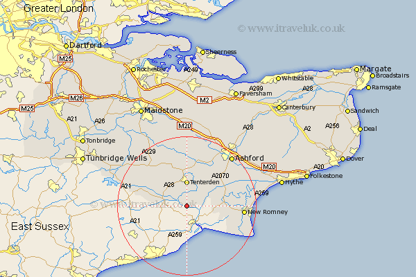
Kent Map Showing Location of Wittersham
Population: 1143
District: Ashford
Easting: 589425 Northing: 125819
Latitude: 51 Longitude: 0.7
 = Wittersham
District: Ashford
Easting: 589425 Northing: 125819
Latitude: 51 Longitude: 0.7
= Wittersham
This Wittersham map below is supplied by Google. Use the tools in the top left corner to zoom into street level or zoom out for a road map, you may also need to zoom in to see Wittersham on the map. Click and drag the map to move around. If the map fails to load try and refresh your browser or zoom in or out (+ or -).
Update - it seems Google no longer allow people to use their maps for free! This Wittersham map sometimes loads and sometimes gives a error. I am working on a solution.
Closest 30 Towns or Cities to Wittersham (Population over 500)
Rolvenden 5.96km Tenterden 7.34km Woodchurch 8.76km High Halden 9.34km Sandhurst 9.51km Benenden 9.87km Beneden 9.87km Ham Street 11.87km Biddenden 12.06km Orlestone 12.85km Bethersden 13.79km Shadoxhurst 13.79km Rockinge 13.98km Ruckinge 13.98km Hawkhurst 14.47km Smarden 14.87km Cranbrook 14.89km Kingsnorth 15.28km Lydd 16.16km New Romney 16.44km Frittenden 16.92km Headcorn 17.67km Hothfield 18.56km Ashford 19.59km Mersham 19.74km Aldington 19.78km Staplehurst 20.34km Egerton 20.51km Pluckley 20.68km Goudhurst 20.71km