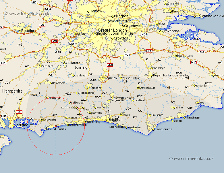
Sussex Map Showing Location of Bognor Regis
Population: 57141
Area Size (ha): 1600
District: Arun
Easting: 495158 Northing: 99123
Latitude: 50.79 Longitude: -0.65
 = Bognor Regis
Area Size (ha): 1600
District: Arun
Easting: 495158 Northing: 99123
Latitude: 50.79 Longitude: -0.65
= Bognor Regis
This Bognor Regis map below is supplied by Google. Use the tools in the top left corner to zoom into street level or zoom out for a road map, you may also need to zoom in to see Bognor Regis on the map. Click and drag the map to move around. If the map fails to load try and refresh your browser or zoom in or out (+ or -).
Update - it seems Google no longer allow people to use their maps for free! This Bognor Regis map sometimes loads and sometimes gives a error. I am working on a solution.
Closest 30 Towns or Cities to Bognor Regis (Population over 500)
Felpham 1.11km Bognor 1.11km Bersted 2.59km Middleton on Sea 2.59km Middleton-on-Sea 2.59km Middleton 2.59km Barnham 2.85km Westergate 2.9km Yapton 3.59km Eastergate 4.45km Ford 5.36km Slindon 6.41km Oving 6.46km Walberton 6.73km Mundham 7.07km North Mundham 7.07km Pagham 7.63km Tangmere 7.85km Boxgrove 7.85km Littlehampton 8.23km Dunnington 9.4km Donnington 9.4km Sidlesham 9.44km Arundel 9.44km Chichester 10.37km Rustington 10.57km Lavant 11.29km Fishbourne 11.44km Selsey 11.51km Angmering 12km