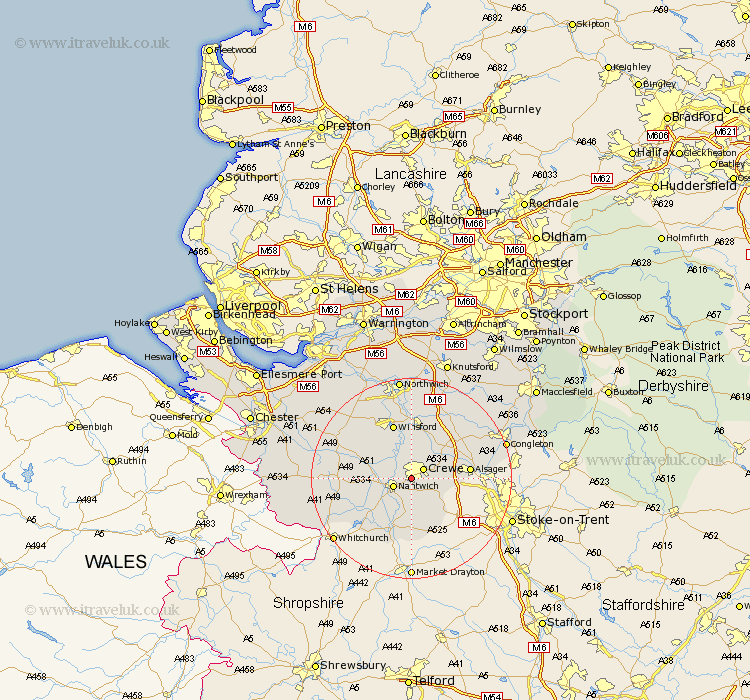
Cheshire Map Showing Location of Wistaston
Population: 8222
District: Crewe and Nantwich
Easting: 368745 Northing: 354143
Latitude: 53.08 Longitude: -2.47
 = Wistaston
District: Crewe and Nantwich
Easting: 368745 Northing: 354143
Latitude: 53.08 Longitude: -2.47
= Wistaston
This Wistaston map below is supplied by Google. Use the tools in the top left corner to zoom into street level or zoom out for a road map, you may also need to zoom in to see Wistaston on the map. Click and drag the map to move around. If the map fails to load try and refresh your browser or zoom in or out (+ or -).
Update - it seems Google no longer allow people to use their maps for free! This Wistaston map sometimes loads and sometimes gives a error. I am working on a solution.
Closest 30 Towns or Cities to Wistaston (Population over 500)
Willaston 2.16km Crewe 2.9km Nantwich 3.82km Wybunbury 5.67km Sandbach 8.69km Alsager 11.28km Middlewick 11.34km Middlewich 11.34km Wrenbury 11.59km Wrenbury cum Frith 11.59km Winsford 11.61km Audlem 11.61km Rode Heath 12.79km Bunbury 12.79km Brereton 12.85km Brereton cum Smethwick 12.85km Little Budworth 14.24km Holmes Chapel 14.59km Tarporley 15.27km Whitegate 15.84km Davenham 17.01km Hartford 17.58km Cuddington 18.9km Goostrey 18.9km Harthill 18.92km Congleton 19.28km Delamere 19.95km Weaverham 20.1km Peover 20.1km Peover Superior 20.1km