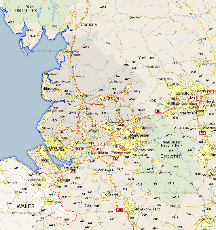
Lancashire Map Showing Location of Bolton
Population: 136288
Area Size (ha): 2992
District: Bolton
Easting: 371315 Northing: 409748
Latitude: 53.58 Longitude: -2.43
 = Bolton
Area Size (ha): 2992
District: Bolton
Easting: 371315 Northing: 409748
Latitude: 53.58 Longitude: -2.43
= Bolton
This Bolton map below is supplied by Google. Use the tools in the top left corner to zoom into street level or zoom out for a road map, you may also need to zoom in to see Bolton on the map. Click and drag the map to move around. If the map fails to load try and refresh your browser or zoom in or out (+ or -).
Update - it seems Google no longer allow people to use their maps for free! This Bolton map sometimes loads and sometimes gives a error. I am working on a solution.
Closest 30 Towns or Cities to Bolton (Population over 500)
Bradshaw 2.88km Bromley Cross 2.88km Farnworth 4.31km Little Lever 5.75km Turton 5.98km Kearsley 6.47km Westhoughton 6.63km Tottington 6.86km Radcliffe 7.57km Walkden 7.73km Tyldesley 7.73km Horwich 7.92km Atherton 8.62km Bury 8.99km Ramsbottom 9.49km Whitefield 9.55km Blackrod 9.9km Pendlebury 9.92km Haigh 10.07km Swinton 10.78km Adlington 11.16km Prestwich 11.36km Hindley 11.36km Abram 12.37km Leigh 12.41km Edenfield 12.78km Eccles 12.94km Darwen 13.16km Ince-in-Makerfield 13.33km Wigan 13.33km