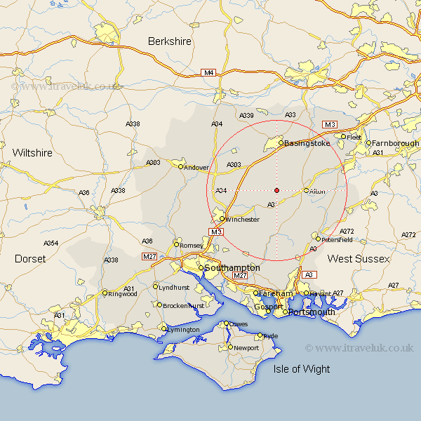
Hampshire Map Showing Location of Wield
Population: 249
District: East Hampshire
Easting: 462964 Northing: 137557
Latitude: 51.13 Longitude: -1.1
 = Wield
District: East Hampshire
Easting: 462964 Northing: 137557
Latitude: 51.13 Longitude: -1.1
= Wield
This Wield map below is supplied by Google. Use the tools in the top left corner to zoom into street level or zoom out for a road map, you may also need to zoom in to see Wield on the map. Click and drag the map to move around. If the map fails to load try and refresh your browser or zoom in or out (+ or -).
Update - it seems Google no longer allow people to use their maps for free! This Wield map sometimes loads and sometimes gives a error. I am working on a solution.
Closest 30 Towns or Cities to Wield (Population over 500)
Medstead 2.97km Four Marks 3.95km New Alresford 7.25km Ropley 7.5km Alton 8.14km Dummer 8.19km Upper Farringdon 8.95km Faringdon 8.95km Farringdon 8.95km North Waltham 9.42km Cheriton 10.37km Bramdean 11.18km Upton Grey 11.6km Micheldever 11.63km Selborne 12.9km West Meon 13.02km Froyle 13.32km Oakley 14.22km Froxfield 14.73km Long Sutton 14.87km Basingstoke 14.88km Kings Worthy 15.03km Wonston 15.23km Binsted 15.23km Overton 15.26km Basing 15.54km Kingsley 16.39km Greatham 16.76km Bentley 17.2km East Meon 17.32km