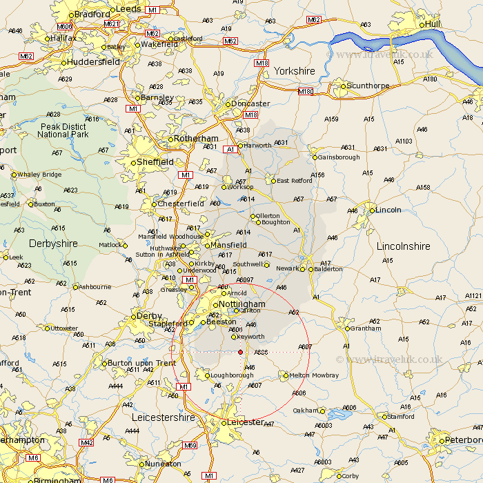
Nottinghamshire Map Showing Location of Widmerpool
Population: 262
District: Rushcliffe
Easting: 462870 Northing: 326642
Latitude: 52.83 Longitude: -1.07
 = Widmerpool
District: Rushcliffe
Easting: 462870 Northing: 326642
Latitude: 52.83 Longitude: -1.07
= Widmerpool
This Widmerpool map below is supplied by Google. Use the tools in the top left corner to zoom into street level or zoom out for a road map, you may also need to zoom in to see Widmerpool on the map. Click and drag the map to move around. If the map fails to load try and refresh your browser or zoom in or out (+ or -).
Update - it seems Google no longer allow people to use their maps for free! This Widmerpool map sometimes loads and sometimes gives a error. I am working on a solution.
Closest 30 Towns or Cities to Widmerpool (Population over 500)
Costock 4.84km Bunny 4.85km Kinoulton 5.9km East Leake 6.97km Cotgrave 7.75km Ruddington 7.89km Gotham 9.15km Cropwell Bishop 9.29km Tollerton 9.34km West Bridgford 9.86km West Bridgeford 9.86km Cropwell 10.83km Cropwell Butler 10.83km Radcliffe-on-Trent 11.34km Radcliffe 11.34km Radcliffe on Trent 11.34km Sutton Bonington 12.32km Carlton 13.02km Colwick 13.02km Barnstone 13.42km Bingham 13.6km Beeston 13.69km Shelford 15.21km Nottingham 16.28km Nottigham 16.28km Stapleford 16.31km Aslockton 16.58km Aslocton 16.58km Lambley 16.68km East Bridgford 16.77km