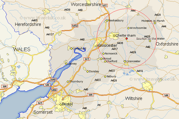
Gloucestershire Map Showing Location of Whittington
Population: 98
District: Cotswold
Easting: 402293 Northing: 220575
Latitude: 51.88 Longitude: -1.97
 = Whittington
District: Cotswold
Easting: 402293 Northing: 220575
Latitude: 51.88 Longitude: -1.97
= Whittington
This Whittington map below is supplied by Google. Use the tools in the top left corner to zoom into street level or zoom out for a road map, you may also need to zoom in to see Whittington on the map. Click and drag the map to move around. If the map fails to load try and refresh your browser or zoom in or out (+ or -).
Update - it seems Google no longer allow people to use their maps for free! This Whittington map sometimes loads and sometimes gives a error. I am working on a solution.
Closest 30 Towns or Cities to Whittington (Population over 500)
Andoversford 2.17km Withington 5.68km Charlton Kings 7.11km Winchcomb 7.5km Winchcombe 7.5km Southam 7.97km Cheltenham 8.22km Leckhampton 8.22km Chedworth 9.88km Bishops Cleeve 10.1km Shurdington 10.46km Swindon 10.7km Alderton 11.35km Northleach 11.71km North Cerney 12.97km Churchdown 13.73km Staverton 14.22km Brockworth 14.22km Dumbleton 14.83km Bourton on the Water 14.99km Bourton-on-the-Water 14.99km Hucclecote 15.33km Innsworth 16.01km Ashchurch 16.56km Cicester 16.72km Cirencester 16.72km Stow-on-the-Wold 16.95km Stow on the Wold 16.95km Bibury 18.06km Tewkesbury 18.06km