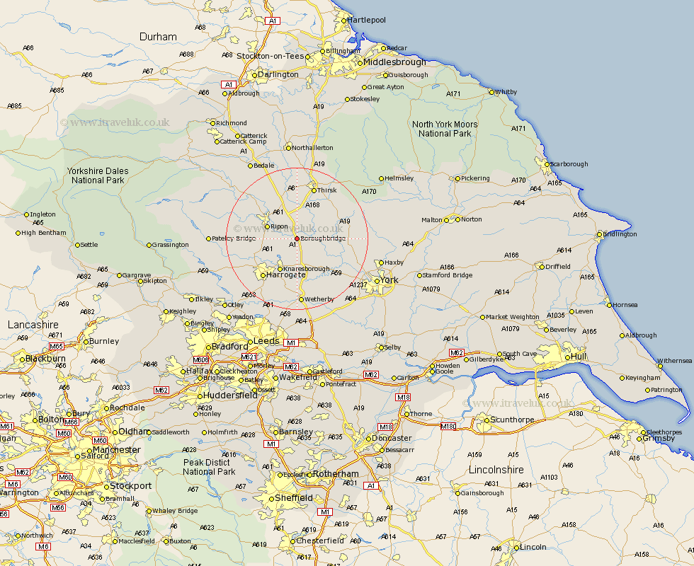
Yorkshire Map Showing Location of Boroughbridge
Population: 1880
Area Size (ha): 79
District: Harrogate
Easting: 439247 Northing: 465451
Latitude: 54.08 Longitude: -1.4
 = Boroughbridge
Area Size (ha): 79
District: Harrogate
Easting: 439247 Northing: 465451
Latitude: 54.08 Longitude: -1.4
= Boroughbridge
This Boroughbridge map below is supplied by Google. Use the tools in the top left corner to zoom into street level or zoom out for a road map, you may also need to zoom in to see Boroughbridge on the map. Click and drag the map to move around. If the map fails to load try and refresh your browser or zoom in or out (+ or -).
Update - it seems Google no longer allow people to use their maps for free! This Boroughbridge map sometimes loads and sometimes gives a error. I am working on a solution.
Closest 30 Towns or Cities to Boroughbridge (Population over 500)
Marton 2.85km Marton le Moor 2.85km Bishop Monkton 6.52km Monkton 6.52km Great Ouseburn 6.58km Ouseburn 6.58km Burton Leonard 6.78km Dishforth 7.5km Ripon 8.47km Whixley 9.19km Knaresborough 10.23km Alne 10.87km Topcliffe 11.17km Raskelf 11.25km Linton on Ouse 11.26km Linton 11.26km Linton upon Ouse 11.26km Linton-on-Ouse 11.26km Green Hammerton 11.33km Tollerton 12.1km Killinghall 12.28km Hammerton 12.9km Kirk Hammerton 12.9km Newton 13.19km Newton upon Ouse 13.19km Easingwold 13.56km Harrogate 14.12km Hampsthwaite 15.01km Birstwith 15.19km Thirsk 15.46km