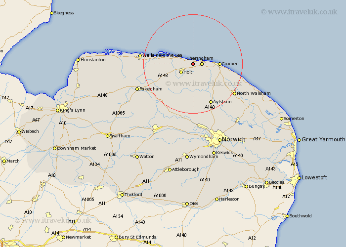
Norfolk Map Showing Location of Weybourne
Population: 518
District: North Norfolk
Easting: 611673 Northing: 342002
Latitude: 52.93 Longitude: 1.15
 = Weybourne
District: North Norfolk
Easting: 611673 Northing: 342002
Latitude: 52.93 Longitude: 1.15
= Weybourne
This Weybourne map below is supplied by Google. Use the tools in the top left corner to zoom into street level or zoom out for a road map, you may also need to zoom in to see Weybourne on the map. Click and drag the map to move around. If the map fails to load try and refresh your browser or zoom in or out (+ or -).
Update - it seems Google no longer allow people to use their maps for free! This Weybourne map sometimes loads and sometimes gives a error. I am working on a solution.
Closest 30 Towns or Cities to Weybourne (Population over 500)
Sheringham 3.35km Holt 5.8km West Runton 6.7km Runton 6.7km Cromer 10.05km Blakeney 10.71km Briston 10.82km Roughton 11.49km Mellon Constable 12.13km Melton Constable 12.13km Northrepps 12.84km Erpingham 12.99km Corpusty 13.01km Overstrand 13.53km Hindolveston 15.75km Aylsham 17.98km Cawston 18.56km Walsingham 18.73km Little Walsingham 18.73km Foulsham 18.93km Foulham 18.93km Little Snoring 19.16km Trunch 19.16km Felmingham 19.27km Mundersley 19.36km Mundesley 19.36km Marsham 19.71km Ryburgh 20.33km Great Ryburgh 20.33km North Walsham 20.33km