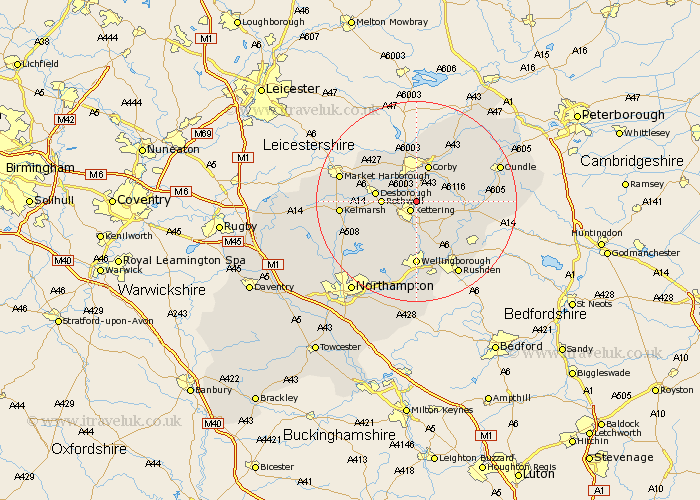
Northamptonshire Map Showing Location of Weekley
Population: 242
District: Kettering
Easting: 488404 Northing: 280692
Latitude: 52.42 Longitude: -0.7
 = Weekley
District: Kettering
Easting: 488404 Northing: 280692
Latitude: 52.42 Longitude: -0.7
= Weekley
This Weekley map below is supplied by Google. Use the tools in the top left corner to zoom into street level or zoom out for a road map, you may also need to zoom in to see Weekley on the map. Click and drag the map to move around. If the map fails to load try and refresh your browser or zoom in or out (+ or -).
Update - it seems Google no longer allow people to use their maps for free! This Weekley map sometimes loads and sometimes gives a error. I am working on a solution.
Closest 30 Towns or Cities to Weekley (Population over 500)
Geddington 2.16km Kettering 2.17km Stanion 6.51km Rothwell 6.78km Rowell 6.78km Broughton 7.17km Isham 7.42km Brigstock 7.72km Corby 7.74km Burton Latimer 7.75km Desborough 8.12km Cottingham 8.14km Weldon 8.68km Wilbarston 10.04km Finedon 10.32km Woodford 10.62km Caldecott 11.18km Thrapston 11.46km Islip 11.9km Walgrave 12.19km Ringstead 12.6km Wellingborough 12.98km Irthlingborough 13.03km Gretton 13.16km Raunds 14.63km Titchmarsh 14.81km Stanwick 15.08km Higham Ferrers 15.2km Sywell 15.88km Great Doddington 16.68km