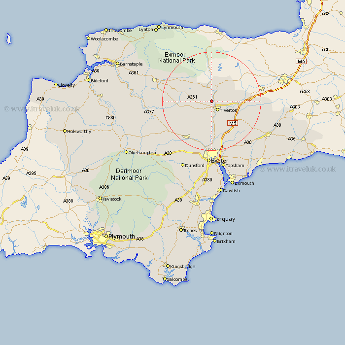
Devon Map Showing Location of Washfield
Population: 362
District: Mid Devon
Easting: 293436 Northing: 116028
Latitude: 50.93 Longitude: -3.52
 = Washfield
District: Mid Devon
Easting: 293436 Northing: 116028
Latitude: 50.93 Longitude: -3.52
= Washfield
This Washfield map below is supplied by Google. Use the tools in the top left corner to zoom into street level or zoom out for a road map, you may also need to zoom in to see Washfield on the map. Click and drag the map to move around. If the map fails to load try and refresh your browser or zoom in or out (+ or -).
Update - it seems Google no longer allow people to use their maps for free! This Washfield map sometimes loads and sometimes gives a error. I am working on a solution.
Closest 30 Towns or Cities to Washfield (Population over 500)
Tiverton 4.38km Bampton 6.03km Halberton 7.93km Sampford Peverell 8.18km Cullompton 11.04km Cheriton Fitzpaine 11.62km Willand 11.89km Holcombe Rogus 12.25km Bradninch 13.15km Silverton 13.18km Uffculme 13.38km Burlescombe 14.14km Witheridge 14.14km Thorverton 14.87km Kentisbeare 15.86km Sandford 16.7km Plymtree 17.46km Stoke Canon 18.56km Culmstock 18.78km Morchard Bishop 18.81km Crediton 19.12km St. Cyres 19.43km St Cyres 19.43km Newton St. Cyres 19.43km Newton St Cyres 19.43km Saint Cyres 19.43km Newton Saint Cyres 19.43km Broad Clyst 19.43km Hemyock 19.94km Broadhembury 20.77km