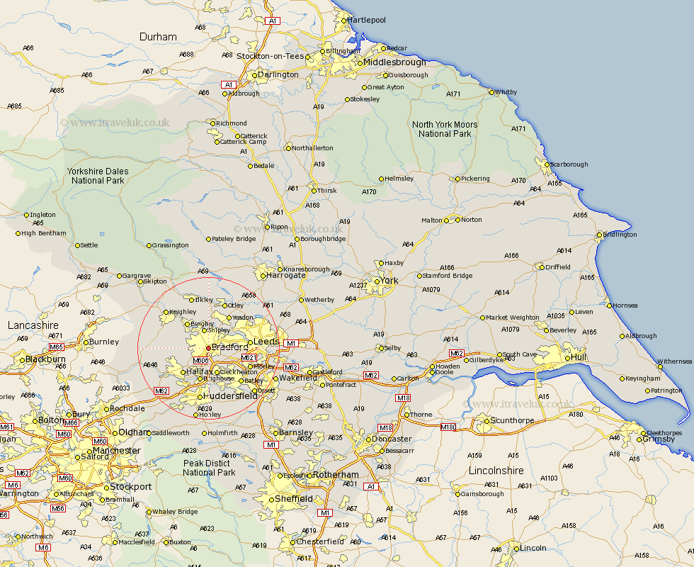
Yorkshire Map Showing Location of Bradford
Population: 285812
Area Size (ha): 6215
District: Bradford
Easting: 416470 Northing: 431939
Latitude: 53.78 Longitude: -1.75
 = Bradford
Area Size (ha): 6215
District: Bradford
Easting: 416470 Northing: 431939
Latitude: 53.78 Longitude: -1.75
= Bradford
This Bradford map below is supplied by Google. Use the tools in the top left corner to zoom into street level or zoom out for a road map, you may also need to zoom in to see Bradford on the map. Click and drag the map to move around. If the map fails to load try and refresh your browser or zoom in or out (+ or -).
Update - it seems Google no longer allow people to use their maps for free! This Bradford map sometimes loads and sometimes gives a error. I am working on a solution.
Closest 30 Towns or Cities to Bradford (Population over 500)
Pudsey 5.47km Shipley 5.67km Baildon 7.5km Cleckheaton 7.72km Wilsden 8.51km Bingley 9.22km Horsforth 9.47km Brighouse 9.52km Guiseley 9.53km Liversedge 9.83km Denholme 9.85km Halifax 9.9km Cullingworth 10.53km Heckmondwike 10.76km Yeadon 10.77km Leeds 11.1km Queensbury 11.11km Menston 11.17km Morley 12.29km Elland 12.4km Dewsbury 12.75km Drewsbury 12.75km Batley 13.08km Oxenhope 13.27km Haworth 13.65km Mirfield 13.69km Otley 13.69km Luddenden Foot 14.15km Bramhope 14.15km Burley in Wharfedale 14.83km