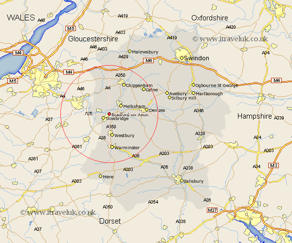
Wiltshire Map Showing Location of Bradford On Avon
Population: 8625
Area Size (ha): 248
District: West Wiltshire
Easting: 386068 Northing: 159431
Latitude: 51.33 Longitude: -2.2
 = Bradford On Avon
Area Size (ha): 248
District: West Wiltshire
Easting: 386068 Northing: 159431
Latitude: 51.33 Longitude: -2.2
= Bradford On Avon
This Bradford On Avon map below is supplied by Google. Use the tools in the top left corner to zoom into street level or zoom out for a road map, you may also need to zoom in to see Bradford On Avon on the map. Click and drag the map to move around. If the map fails to load try and refresh your browser or zoom in or out (+ or -).
Update - it seems Google no longer allow people to use their maps for free! This Bradford On Avon map sometimes loads and sometimes gives a error. I am working on a solution.
Closest 30 Towns or Cities to Bradford On Avon (Population over 500)
Holt 1.86km Hilperton 2.18km Trowbridge 2.96km Broughton Gifford 3.89km Semington 3.94km Atworth 5.56km Whitley 5.57km North Bradley 5.68km Steeple Ashton 5.93km Melksham 5.94km Southwick 6.02km Westwood 6.08km Seend 8.31km Limpley Stoke 9.26km Westbury 9.33km Bratton 9.4km Lacock 9.41km Laycock 9.41km Worton 9.45km Box 9.9km Edington 10.16km Erlestoke 10.81km Dilton 11.12km Corsham 11.36km Rowde 11.73km Colerne 12.04km Potterne 12.87km Corsley 13.42km Chippenham 14.21km Warminster 14.87km