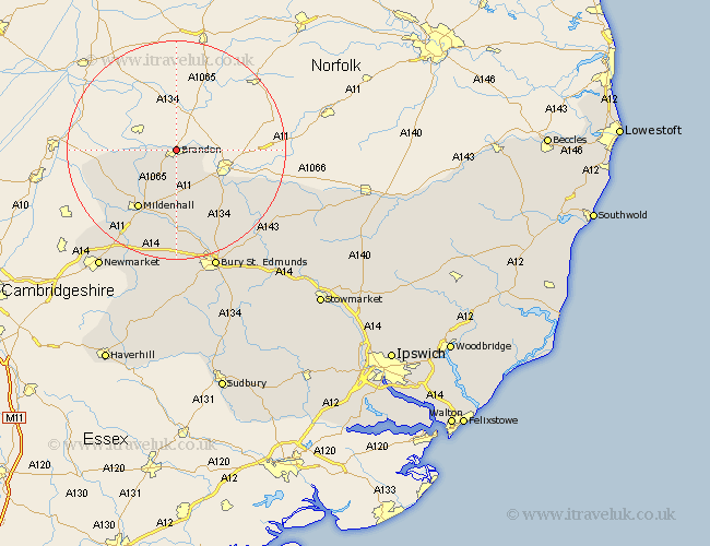
Suffolk Map Showing Location of Brandon
Population: 7681
Area Size (ha): 261
District: Forest Heath
Easting: 577795 Northing: 286821
Latitude: 52.45 Longitude: 0.62
 = Brandon
Area Size (ha): 261
District: Forest Heath
Easting: 577795 Northing: 286821
Latitude: 52.45 Longitude: 0.62
= Brandon
This Brandon map below is supplied by Google. Use the tools in the top left corner to zoom into street level or zoom out for a road map, you may also need to zoom in to see Brandon on the map. Click and drag the map to move around. If the map fails to load try and refresh your browser or zoom in or out (+ or -).
Update - it seems Google no longer allow people to use their maps for free! This Brandon map sometimes loads and sometimes gives a error. I am working on a solution.
Closest 30 Towns or Cities to Brandon (Population over 500)
Lakenheath 3.86km Lake Heath 3.86km Eriswell 10.85km Barnham 12.18km Mildenhall 13.03km Honington 17.98km Troston 18.65km Risby 20.41km Fornham All Saints 21.15km Bardwell 21.69km Barningham 22.21km Ixworth 22.24km Great Barton 22.79km Gazeley 23.25km Bury St. Edmunds 23.25km Bury Saint Edmunds 23.25km Bury St Edmunds 23.25km Hopton 23.39km Moulton 24.01km Hepworth 24.14km Barrow 24.2km Stanton 24.28km Pakenham 25.14km Thurston 26.06km Newmarket 26.06km Exning 27.26km Badwell Ash 27.54km Redgrave 27.6km Chevington 27.8km Rushbrooke 27.87km