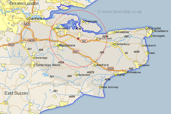
Kent Map Showing Location of Tunstall
Population: 877
District: Swale
Easting: 589293 Northing: 161070
Latitude: 51.32 Longitude: 0.72
 = Tunstall
District: Swale
Easting: 589293 Northing: 161070
Latitude: 51.32 Longitude: 0.72
= Tunstall
This Tunstall map below is supplied by Google. Use the tools in the top left corner to zoom into street level or zoom out for a road map, you may also need to zoom in to see Tunstall on the map. Click and drag the map to move around. If the map fails to load try and refresh your browser or zoom in or out (+ or -).
Update - it seems Google no longer allow people to use their maps for free! This Tunstall map sometimes loads and sometimes gives a error. I am working on a solution.
Closest 30 Towns or Cities to Tunstall (Population over 500)
Borden 1.16km Bredgar 2.19km Sittingbourne 2.96km Bapchild 3.47km Bobbing 3.88km Stockbury 4.63km Lynsted 4.99km Linsted 4.99km Newington 5.08km Iwade 5.68km Lower Halstow 6.56km Doddington 6.56km Teynham 7.19km Upchurch 7.24km Hollingbourne 8.75km Lenham 9.27km Harrietsham 9.56km Detling 9.99km Ospringe 10.59km Oare 11.58km Leeds 11.59km Queenborough 11.65km Bearsted 11.82km Boxley 12.17km Faversham 12.74km Gillingham 12.78km Minster 13.11km Langley 13.12km Sheerness 13.42km Ulcombe 13.78km