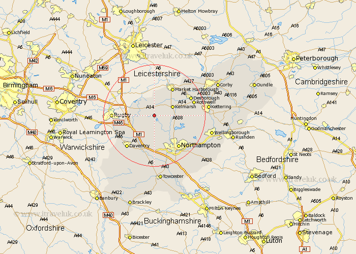
Northamptonshire Map Showing Location of Thornby
Population: 162
District: Daventry
Easting: 466945 Northing: 274791
Latitude: 52.37 Longitude: -1.02
 = Thornby
District: Daventry
Easting: 466945 Northing: 274791
Latitude: 52.37 Longitude: -1.02
= Thornby
This Thornby map below is supplied by Google. Use the tools in the top left corner to zoom into street level or zoom out for a road map, you may also need to zoom in to see Thornby on the map. Click and drag the map to move around. If the map fails to load try and refresh your browser or zoom in or out (+ or -).
Update - it seems Google no longer allow people to use their maps for free! This Thornby map sometimes loads and sometimes gives a error. I am working on a solution.
Closest 30 Towns or Cities to Thornby (Population over 500)
Naseby 2.92km Guilsborough 3.88km West Haddon 5.03km Welford 6km Yelvertoft 6.79km Clipston 7.17km Spratton 7.17km East Haddon 7.42km Long Buckby 8.16km Crick 8.75km Brixworth 9.68km Kilsby 10.84km Pitsford 11.71km Boughton 12.2km Welton 12.96km Barby 13.64km Walgrave 14.08km Moulton 14.64km Flore 15km Harpole 15km Desborough 15.46km Braunston 15.53km Rowell 15.72km Rothwell 15.72km Northampton 15.83km Overstone 16.45km Daventry 16.5km Broughton 16.97km Kislingbury 17.02km Weedon 17.02km