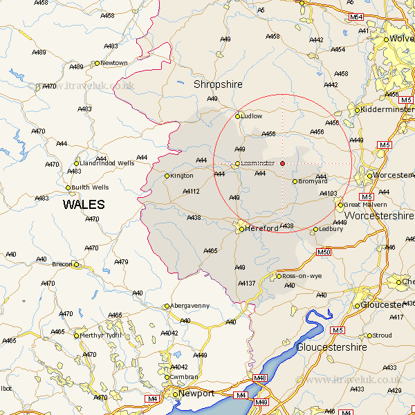
Herefordshire Map Showing Location of Thornbury
Population: 122
Easting: 362442 Northing: 259642
Latitude: 52.23 Longitude: -2.55
 = Thornbury
Easting: 362442 Northing: 259642
Latitude: 52.23 Longitude: -2.55
= Thornbury
This Thornbury map below is supplied by Google. Use the tools in the top left corner to zoom into street level or zoom out for a road map, you may also need to zoom in to see Thornbury on the map. Click and drag the map to move around. If the map fails to load try and refresh your browser or zoom in or out (+ or -).
Update - it seems Google no longer allow people to use their maps for free! This Thornbury map sometimes loads and sometimes gives a error. I am working on a solution.
Closest 30 Towns or Cities to Thornbury (Population over 500)
Bromyard 6.52km Whitbourne 10.38km Leominster 12.49km Brimfield 12.62km Bodenham 12.98km Luston 14.11km Orleton 15.5km Withington 15.87km Kingsland 17.12km Sutton 17.39km Wellington 17.59km Croft 17.9km Bosbury 18.02km Moreton-on-Lugg 19.39km Moreton on Lugg 19.39km Moreton 19.39km Lugwardine 19.74km Colwall 20.19km Eardisland 20.52km Cradley 20.67km Burghill 20.93km Mordiford 21.16km Shobdon 21.64km Dilwyn 22.28km Ledbury 22.32km Wigmore 22.42km Credenhill 22.59km Weobley 22.82km Hereford 23.34km Pembridge 23.91km