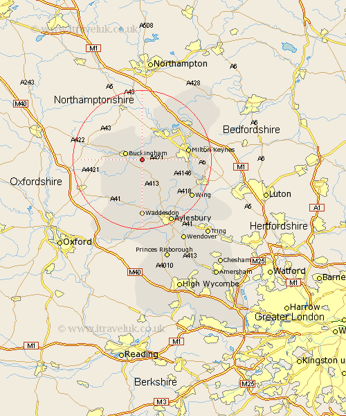
Buckinghamshire Map Showing Location of Thornborough
Population: 562
District: Aylesbury Vale
Easting: 474390 Northing: 232250
Latitude: 51.98 Longitude: -0.92
 = Thornborough
District: Aylesbury Vale
Easting: 474390 Northing: 232250
Latitude: 51.98 Longitude: -0.92
= Thornborough
This Thornborough map below is supplied by Google. Use the tools in the top left corner to zoom into street level or zoom out for a road map, you may also need to zoom in to see Thornborough on the map. Click and drag the map to move around. If the map fails to load try and refresh your browser or zoom in or out (+ or -).
Update - it seems Google no longer allow people to use their maps for free! This Thornborough map sometimes loads and sometimes gives a error. I am working on a solution.
Closest 30 Towns or Cities to Thornborough (Population over 500)
Padbury 2.94km Great Horwood 3.89km Maids Moreton 3.89km Buckingham 4.93km Winslow 5.04km Gawcott 6km Akeley 6.53km Claydon 7.2km Steeple Claydon 7.2km Stowe 7.79km Stony Stratford 8.71km Mursley 8.82km Tingewick 9.13km Twyford 9.74km Shenley 9.85km Shenley Church End 9.85km Wolverton 10.09km Shenley Brook End 10.44km Newton Longville 10.44km Bradwell 10.69km North Marston 11.64km Castlethorpe 12.5km Whitechurch 12.5km Whitchurch 12.5km Bletchley 12.56km Quainton 12.97km Marsh Gibbon 13.01km Milton Keynes 13.13km Stewkley 13.61km Grendon Underwood 14.17km