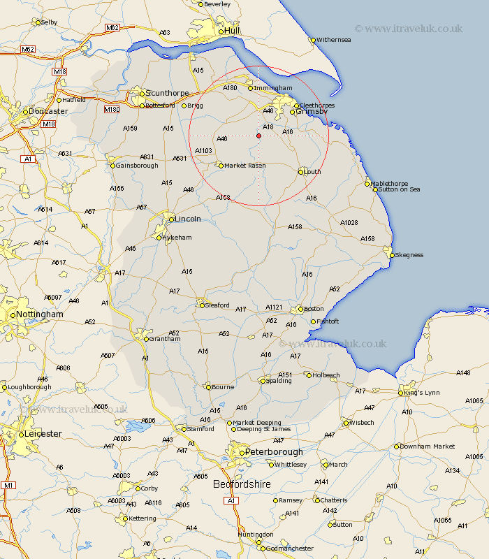
Lincolnshire Map Showing Location of Thorganby
Population: 44
District: West Lindsey
Easting: 520580 Northing: 398226
Latitude: 53.47 Longitude: -0.18
 = Thorganby
District: West Lindsey
Easting: 520580 Northing: 398226
Latitude: 53.47 Longitude: -0.18
= Thorganby
This Thorganby map below is supplied by Google. Use the tools in the top left corner to zoom into street level or zoom out for a road map, you may also need to zoom in to see Thorganby on the map. Click and drag the map to move around. If the map fails to load try and refresh your browser or zoom in or out (+ or -).
Update - it seems Google no longer allow people to use their maps for free! This Thorganby map sometimes loads and sometimes gives a error. I am working on a solution.
Closest 30 Towns or Cities to Thorganby (Population over 500)
binbrook 3.71km Laceby 7.49km Waltham 7.83km North Thoresby 8.83km Nettleton 9.01km Caistor 9.01km Holton le Clay 9.51km Healing 11.17km Tetney 11.18km Fulstow 11.19km Grimsby 11.52km Great Grimsby 11.52km South Killingholme 11.6km Keelby 11.96km Humberstone 12.38km Humberston 12.38km Great Coates 12.94km Stallingborough 12.97km Cleethorpes 13.57km Market Rasen 13.59km North Coates 14.34km Immingham 14.99km Middle Rasen 15.28km Habrough 15.46km North Kelsey 15.55km Louth 15.67km South Kelsey 16.55km Grainthorpe 17.65km Barnetby 18.13km Barnetby le Wold 18.13km