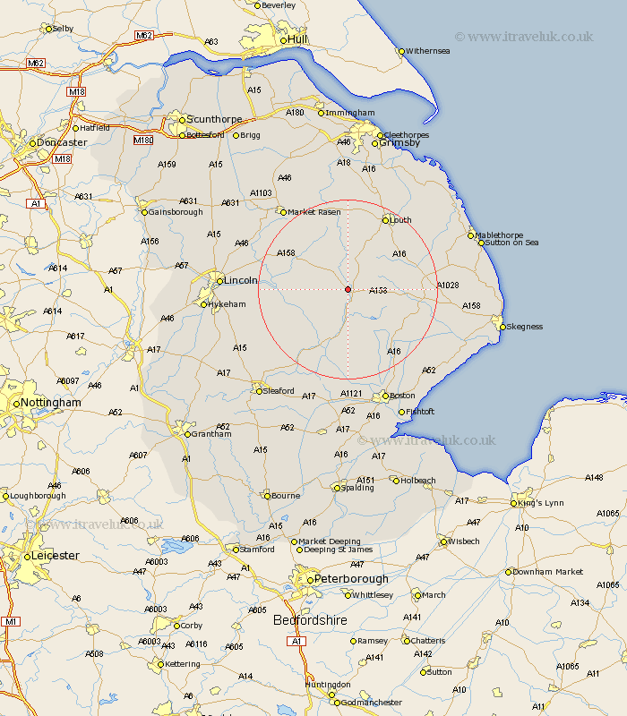
Lincolnshire Map Showing Location of Thimbleby
Population: 250
District: East Lindsey
Easting: 524626 Northing: 370506
Latitude: 53.22 Longitude: -0.13
 = Thimbleby
District: East Lindsey
Easting: 524626 Northing: 370506
Latitude: 53.22 Longitude: -0.13
= Thimbleby
This Thimbleby map below is supplied by Google. Use the tools in the top left corner to zoom into street level or zoom out for a road map, you may also need to zoom in to see Thimbleby on the map. Click and drag the map to move around. If the map fails to load try and refresh your browser or zoom in or out (+ or -).
Update - it seems Google no longer allow people to use their maps for free! This Thimbleby map sometimes loads and sometimes gives a error. I am working on a solution.
Closest 30 Towns or Cities to Thimbleby (Population over 500)
Horncastle 2.16km Banovallum 2.16km Mareham-on-the-Hill 5.79km Mareham 5.79km Mareham on the Hill 5.79km Woodhall Spa 9.26km Coningsby 11.34km Bardney 12.21km Wragby 13.33km Tattershall 13.72km Carrington 15.84km Spilsby 15.98km Holton 16.21km Martin 17.36km Legbourne 17.8km Billinghay 17.89km Stickney 17.89km Louth 18.39km Potter Hanworth 19.23km Dunston 19.26km Cherry Willingham 19.63km Nocton 19.68km Metheringham 20.05km Fiskerton 20.06km Reepham 20.06km Alford 21.4km Frithville 21.46km Digby 21.5km Sudbrooke 21.79km Scopwick 22.01km