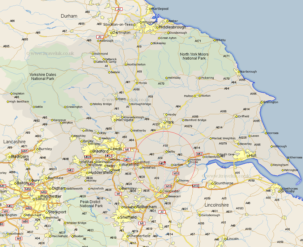
Yorkshire Map Showing Location of Temple Hirst
Population: 133
District: Selby
Easting: 460487 Northing: 424891
Latitude: 53.72 Longitude: -1.08
 = Temple Hirst
District: Selby
Easting: 460487 Northing: 424891
Latitude: 53.72 Longitude: -1.08
= Temple Hirst
This Temple Hirst map below is supplied by Google. Use the tools in the top left corner to zoom into street level or zoom out for a road map, you may also need to zoom in to see Temple Hirst on the map. Click and drag the map to move around. If the map fails to load try and refresh your browser or zoom in or out (+ or -).
Update - it seems Google no longer allow people to use their maps for free! This Temple Hirst map sometimes loads and sometimes gives a error. I am working on a solution.
Closest 30 Towns or Cities to Temple Hirst (Population over 500)
Hensall 2.16km Carlton 4.76km Snaith 4.96km Brayton 5.56km Pollington 5.67km Barlow 5.74km Whitley 5.75km Selby 7.49km Hambleton 7.81km Cliffe Common 8.61km Cliff Common Station 8.61km Hemingbrough 8.61km Rawcliffe 9.53km Knottingly 10.04km Knottingley 10.04km Monk Fryston 10.54km Wistow 11.17km Norton 11.37km Askern 11.6km Brotherton 12.06km Airmyn 12.06km South Milford 12.29km Darrington 12.3km Campsall 12.92km Riccall 13.15km Cawood 13.15km Stainforth 13.39km Fishlake 13.7km Sutton 14.09km Church Fenton 14.16km