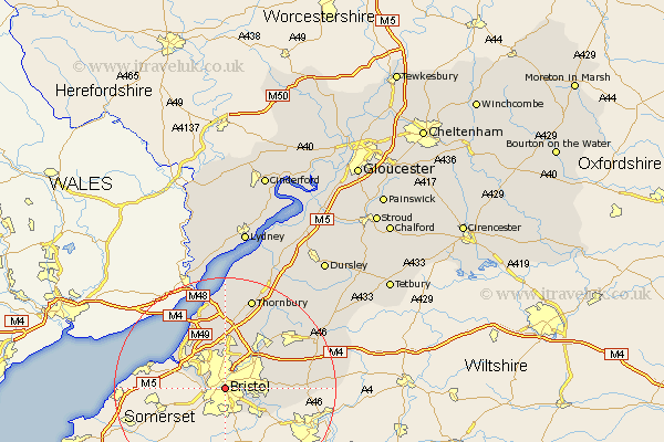
Gloucestershire Map Showing Location of Bristol
Population: 403575
Area Size (ha): 10078
Easting: 359469 Northing: 172550
Latitude: 51.45 Longitude: -2.58
 = Bristol
Area Size (ha): 10078
Easting: 359469 Northing: 172550
Latitude: 51.45 Longitude: -2.58
= Bristol
This Bristol map below is supplied by Google. Use the tools in the top left corner to zoom into street level or zoom out for a road map, you may also need to zoom in to see Bristol on the map. Click and drag the map to move around. If the map fails to load try and refresh your browser or zoom in or out (+ or -).
Update - it seems Google no longer allow people to use their maps for free! This Bristol map sometimes loads and sometimes gives a error. I am working on a solution.
Closest 30 Towns or Cities to Bristol (Population over 500)
Kingswood 6.06km Filton 7.5km Stoke Gifford 7.76km Mangotsfield 8.89km Patchway 9.33km Siston 9.42km Bitton 9.96km Wick 10.39km Almondsbury 11.18km Winterbourne 11.48km Frampton Cotterell 11.56km Pilning 11.65km Westerleigh 12.76km Iron Acton 13.74km Olveston 14.87km Rangeworthy 15.92km Chipping Sodbury 16.66km Aust 16.84km Alveston 17.03km Thornbury 17.31km Tytherington 18.06km Marshfield 19.63km Wickwar 20.28km Cromhall 20.7km Charfield 21.83km Falfield 22.37km Tidenham 22.71km Hawkesbury 22.78km Stone 23.66km Wotton-under-Edge 26km