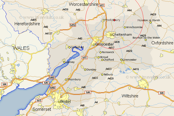
Gloucestershire Map Showing Location of Teddington
Population: 412
District: Tewkesbury
Easting: 396567 Northing: 233554
Latitude: 52 Longitude: -2.05
 = Teddington
District: Tewkesbury
Easting: 396567 Northing: 233554
Latitude: 52 Longitude: -2.05
= Teddington
This Teddington map below is supplied by Google. Use the tools in the top left corner to zoom into street level or zoom out for a road map, you may also need to zoom in to see Teddington on the map. Click and drag the map to move around. If the map fails to load try and refresh your browser or zoom in or out (+ or -).
Update - it seems Google no longer allow people to use their maps for free! This Teddington map sometimes loads and sometimes gives a error. I am working on a solution.
Closest 30 Towns or Cities to Teddington (Population over 500)
Alderton 3.9km Ashchurch 4.56km Bishops Cleeve 5.68km Dumbleton 6km Tewkesbury 6.85km Southam 7.42km Swindon 8.17km Winchcombe 8.82km Winchcomb 8.82km Deerhurst 10.92km Cheltenham 11.35km Staverton 12.24km Charlton Kings 14.87km Leckhampton 15km Churchdown 15.24km Shurdington 15.51km Andoversford 16.33km Innsworth 16.56km Ashleworth 16.59km Brockworth 18.5km Chipping Campden 18.62km Corse 18.66km Hucclecote 19.02km Hartpury 19.47km Withington 19.76km Blockley 20.62km Redmarley D'Abitot 20.62km Mickleton 21.48km Ebrington 22.37km Stow-on-the-Wold 22.93km