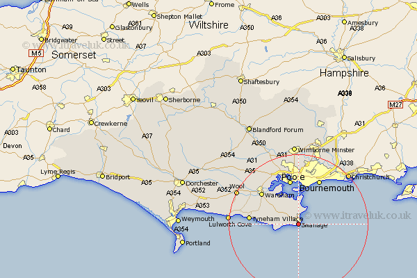
Dorset Map Showing Location of Swanage
Population: 10491
Area Size (ha): 320
District: Purbeck
Easting: 402358 Northing: 77874
Latitude: 50.6 Longitude: -1.97
 = Swanage
Area Size (ha): 320
District: Purbeck
Easting: 402358 Northing: 77874
Latitude: 50.6 Longitude: -1.97
= Swanage
This Swanage map below is supplied by Google. Use the tools in the top left corner to zoom into street level or zoom out for a road map, you may also need to zoom in to see Swanage on the map. Click and drag the map to move around. If the map fails to load try and refresh your browser or zoom in or out (+ or -).
Update - it seems Google no longer allow people to use their maps for free! This Swanage map sometimes loads and sometimes gives a error. I am working on a solution.
Closest 30 Towns or Cities to Swanage (Population over 500)
Langton Matravers 3.53km Studland 4.39km Worth Matravers 4.7km Worth 4.7km Corfe Castle 6.95km Arne 12.07km Poole 13.19km Wareham 14.06km Bournemouth 14.24km Holton Heath Station 15.36km Holton Heath 15.36km Lytchett Matravers 18.11km Parley 19.83km West Parley 19.83km Lulworth Cove 20.08km West Lulworth 20.08km Wool 20.09km Christchurch 20.45km Corfe Mullen 20.92km Burton 21.28km Sturminster Marshall 21.56km Winfrith Newburgh 21.88km Winfrith 21.88km Bovington Camp 22.86km Fern Down 23.33km Ferndown 23.33km Wimborne 23.38km Wimborne Minster 23.38km Bere Regis 24.26km West Moors 24.55km