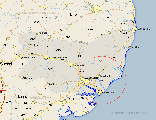
Suffolk Map Showing Location of Sutton
Population: 1135
District: Suffolk Coastal
Easting: 629583 Northing: 246268
Latitude: 52.07 Longitude: 1.35
 = Sutton
District: Suffolk Coastal
Easting: 629583 Northing: 246268
Latitude: 52.07 Longitude: 1.35
= Sutton
This Sutton map below is supplied by Google. Use the tools in the top left corner to zoom into street level or zoom out for a road map, you may also need to zoom in to see Sutton on the map. Click and drag the map to move around. If the map fails to load try and refresh your browser or zoom in or out (+ or -).
Update - it seems Google no longer allow people to use their maps for free! This Sutton map sometimes loads and sometimes gives a error. I am working on a solution.
Closest 30 Towns or Cities to Sutton (Population over 500)
Sutton 0km Martlesham 3.88km Melton 4.35km Woodbridge 4.35km Martlesham Heath 4.56km Ufford 5.56km Hollesley 5.99km Rendlesham 7.19km Kirton 7.76km Kirkton 7.76km Grundisburgh 7.77km Bucklesham 7.78km Wickham Market 9.33km Nacton 9.73km Tunstall 10.07km Felixstowe 11.12km Walton 11.31km Wirnesham 11.98km Witnesham 11.98km Otley 12.22km Ipswich 12.66km Orford 12.66km Chelmondiston 13.01km Shotley 13.06km Henley 14.75km Holbrook 15.6km Claydon 16.05km Snape 16.52km Framlingham 16.72km Bramford 17.09km