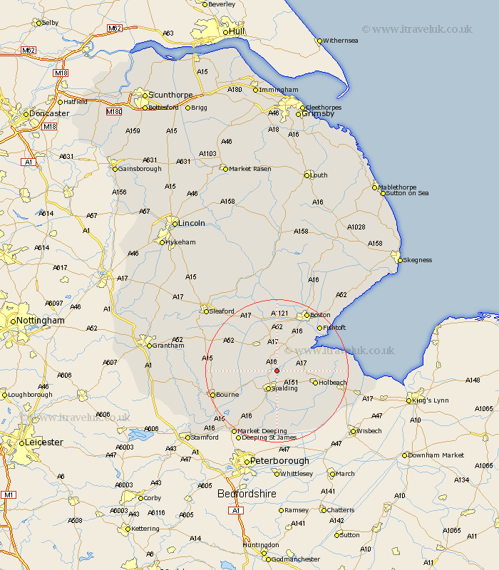
Lincolnshire Map Showing Location of Surfleet
Population: 1266
District: South Holland
Easting: 525736 Northing: 327866
Latitude: 52.83 Longitude: -0.13
 = Surfleet
District: South Holland
Easting: 525736 Northing: 327866
Latitude: 52.83 Longitude: -0.13
= Surfleet
This Surfleet map below is supplied by Google. Use the tools in the top left corner to zoom into street level or zoom out for a road map, you may also need to zoom in to see Surfleet on the map. Click and drag the map to move around. If the map fails to load try and refresh your browser or zoom in or out (+ or -).
Update - it seems Google no longer allow people to use their maps for free! This Surfleet map sometimes loads and sometimes gives a error. I am working on a solution.
Closest 30 Towns or Cities to Surfleet (Population over 500)
Gosberton 2.17km Pinchbeck 3.87km Quadring 4.34km Weston 5.81km Spalding 5.99km Moulton 7.89km Sutterton 8.14km Donington 8.66km Whaplode 8.72km Bicker 9.54km Holbeach 10.74km Kirton 10.83km Cowbit 11.18km Swineshead 11.18km Frampton 12.14km Pointon 13.56km Wyberton 13.6km Deeping St Nicholas 13.72km Deeping Saint Nicholas 13.72km Deeping St. Nicholas 13.72km Billingborough 14.53km Fleet 14.55km Helpringham 15.77km Rippingale 15.79km Hale 16.42km Great Hale 16.42km Morton 16.64km Gedney 16.64km Brothertoft 16.83km Fishtoft 17.13km