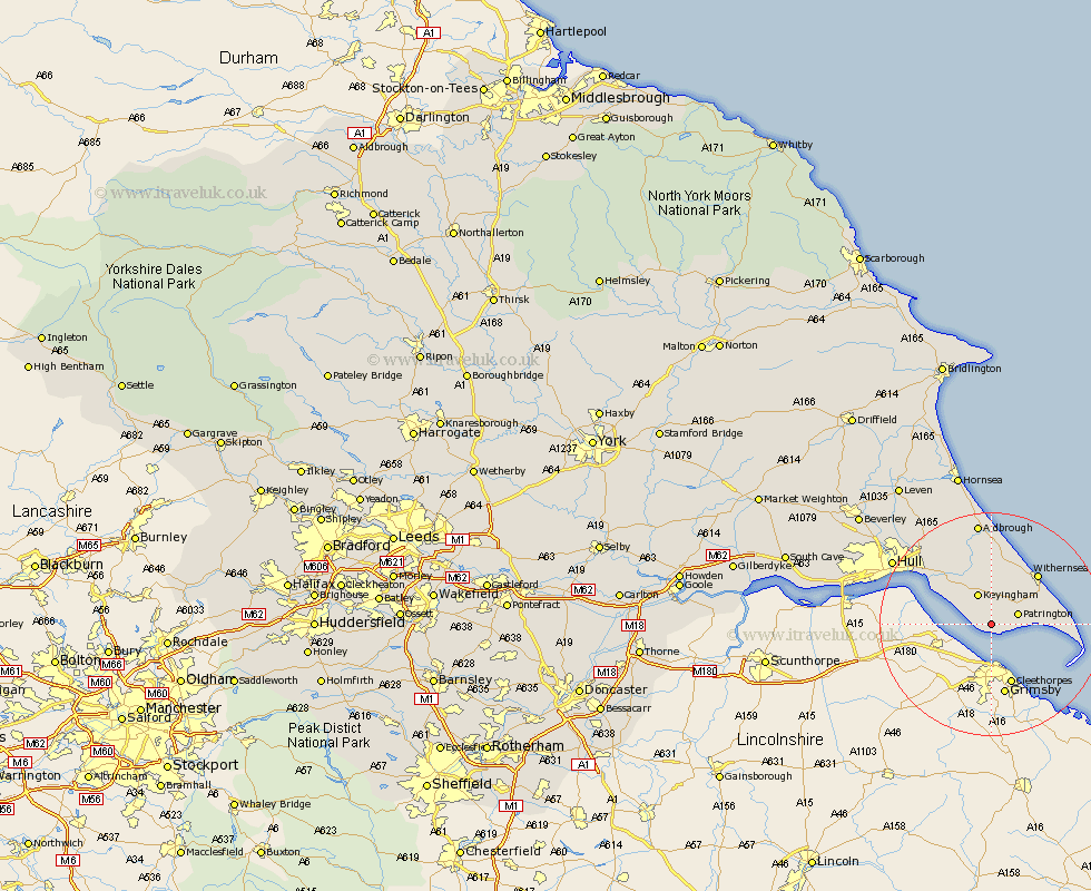
Yorkshire Map Showing Location of Sunk Island
Population: 224
Easting: 526668 Northing: 418787
Latitude: 53.65 Longitude: -0.08
 = Sunk Island
Easting: 526668 Northing: 418787
Latitude: 53.65 Longitude: -0.08
= Sunk Island
This Sunk Island map below is supplied by Google. Use the tools in the top left corner to zoom into street level or zoom out for a road map, you may also need to zoom in to see Sunk Island on the map. Click and drag the map to move around. If the map fails to load try and refresh your browser or zoom in or out (+ or -).
Update - it seems Google no longer allow people to use their maps for free! This Sunk Island map sometimes loads and sometimes gives a error. I am working on a solution.
Closest 30 Towns or Cities to Sunk Island (Population over 500)
Patrington 4.77km Ottringham 5.56km Keyingham 5.98km Thorngumbold 9.23km Thorngumbald 9.23km Burstwick 9.83km Roos 11.33km Hedon 11.36km Withernsea 12.03km Paull 12.35km Burton Pidsea 13.02km Easington 13.31km Preston 15.08km Sproatley 16.22km Kingston upon Hull 18.06km Aldbrough 18.67km Walkington 18.67km Hull 20.29km Sutton on Hull 21.34km Sutton 21.34km Sutton-on-Hull 21.34km Skirlaugh Station 21.53km Barton 23.35km Barton upon Humber 23.35km Wawne 24.21km Hessle 24.21km Cottingham 24.69km Anlaby 24.84km Kirk Ella 26.58km Woodmansey 27.07km