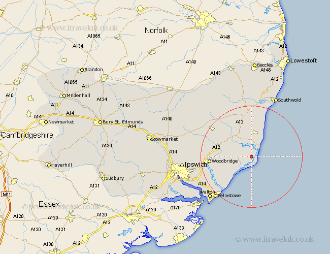
Suffolk Map Showing Location of Sudbourne
Population: 307
District: Suffolk Coastal
Easting: 643013 Northing: 252477
Latitude: 52.12 Longitude: 1.55
 = Sudbourne
District: Suffolk Coastal
Easting: 643013 Northing: 252477
Latitude: 52.12 Longitude: 1.55
= Sudbourne
This Sudbourne map below is supplied by Google. Use the tools in the top left corner to zoom into street level or zoom out for a road map, you may also need to zoom in to see Sudbourne on the map. Click and drag the map to move around. If the map fails to load try and refresh your browser or zoom in or out (+ or -).
Update - it seems Google no longer allow people to use their maps for free! This Sudbourne map sometimes loads and sometimes gives a error. I am working on a solution.
Closest 30 Towns or Cities to Sudbourne (Population over 500)
Orford 3.88km Aldeburgh 5.04km Tunstall 7.07km Thorpeness 7.18km Thorpe 7.18km Snape 8.15km Rendlesham 9.1km Leiston 9.33km Hollesley 10.89km Saxmundham 11.63km Wickham Market 13.05km Ufford 13.66km Sutton 14.75km Melton 16.04km Woodbridge 16.04km Yoxford 16.83km Martlesham 17.48km Framlingham 18.49km Martlesham Heath 19.05km Kirkton 20.56km Kirton 20.56km Grundisburgh 20.57km Felixstowe 21.57km Otley 21.93km Wenhaston 22.24km Bucklesham 22.5km Walton 22.93km Cookley 23.26km Dennington 23.85km Laxfield 23.91km