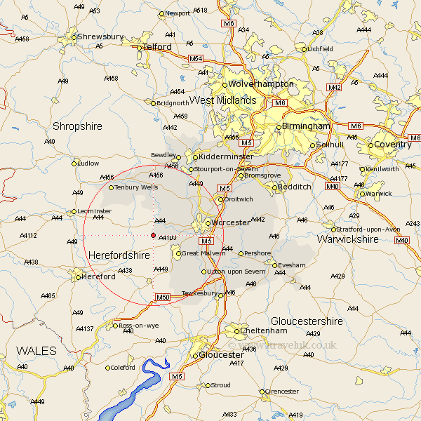
Worcestershire Map Showing Location of Suckley
Population: 549
District: Malvern Hills
Easting: 371504 Northing: 252175
Latitude: 52.17 Longitude: -2.42
 = Suckley
District: Malvern Hills
Easting: 371504 Northing: 252175
Latitude: 52.17 Longitude: -2.42
= Suckley
This Suckley map below is supplied by Google. Use the tools in the top left corner to zoom into street level or zoom out for a road map, you may also need to zoom in to see Suckley on the map. Click and drag the map to move around. If the map fails to load try and refresh your browser or zoom in or out (+ or -).
Update - it seems Google no longer allow people to use their maps for free! This Suckley map sometimes loads and sometimes gives a error. I am working on a solution.
Closest 30 Towns or Cities to Suckley (Population over 500)
Leigh 7.06km Martley 8.15km Great Malvern 8.8km Malvern 8.8km Clifton upon Teme 9.26km Clifton 9.26km Malvern Wells 10.88km Powick 11.37km Hallow 12.65km Grimley 13.56km Great Witley 13.74km Holt 14.65km Abberley 15.21km Welland 15.23km Worcester 15.23km Kempsey 15.24km Seven Stoke 15.54km Severn Stoke 15.54km Hanley Castle 15.58km Astley 16.31km Fernhill Heath 16.52km Ombersley 16.72km Castlemorton 16.84km Lindridge 17.02km Upton upon Severn 17.61km Upton 17.61km Upton-on-Severn 17.61km Upton on Severn 17.61km Rock 18.56km Tenbury Wells 18.67km